File:Territorial waters - Kiribati.svg
Jump to navigation
Jump to search

Size of this PNG preview of this SVG file: 800 × 400 pixels. Other resolutions: 320 × 160 pixels | 640 × 320 pixels | 1,024 × 512 pixels | 1,280 × 640 pixels | 2,560 × 1,280 pixels.
Original file (SVG file, nominally 800 × 400 pixels, file size: 694 KB)
Captions
Captions
Add a one-line explanation of what this file represents
Summary
[edit]
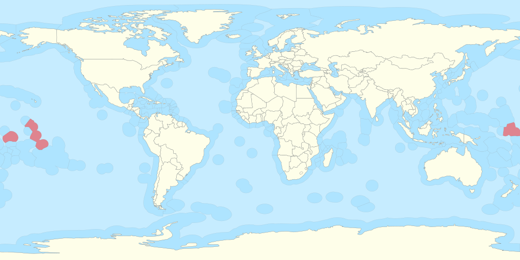
| Description |
Español: Territorio de Kiribati y sus aguas territoriales. English: Territory of Kiribati and its territorial waters. |
| Date | |
| Source |
Own work based on: Exclusive Economic Zones - World.svg: |
| Author | B1mbo |
| Permission (Reusing this file) |
I, the copyright holder of this work, hereby publish it under the following license: This file is licensed under the Creative Commons Attribution-ShareAlike 3.0 Chile license.
 |
| SVG development |
File history
Click on a date/time to view the file as it appeared at that time.
| Date/Time | Thumbnail | Dimensions | User | Comment | |
|---|---|---|---|---|---|
| current | 03:02, 12 May 2020 | | 800 × 400 (694 KB) | Ratherous (talk | contribs) | Sea of Okhotsk entirely Russian since 2014 |
| 18:06, 1 November 2011 |  | 800 × 400 (695 KB) | B1mbo (talk | contribs) |
You cannot overwrite this file.
File usage on Commons
There are no pages that use this file.
File usage on other wikis
The following other wikis use this file:
- Usage on ar.wikipedia.org
- Usage on en.wikipedia.org
- Usage on id.wikipedia.org