File:Talim 2017-09-14 0215Z.jpg
Jump to navigation
Jump to search
Size of this preview: 450 × 600 pixels. Other resolutions: 180 × 240 pixels | 360 × 480 pixels | 576 × 768 pixels | 768 × 1,024 pixels | 1,536 × 2,048 pixels | 5,490 × 7,320 pixels.
Original file (5,490 × 7,320 pixels, file size: 5.65 MB, MIME type: image/jpeg)
Captions
Captions
Add a one-line explanation of what this file represents
Summary
[edit]
| Description |
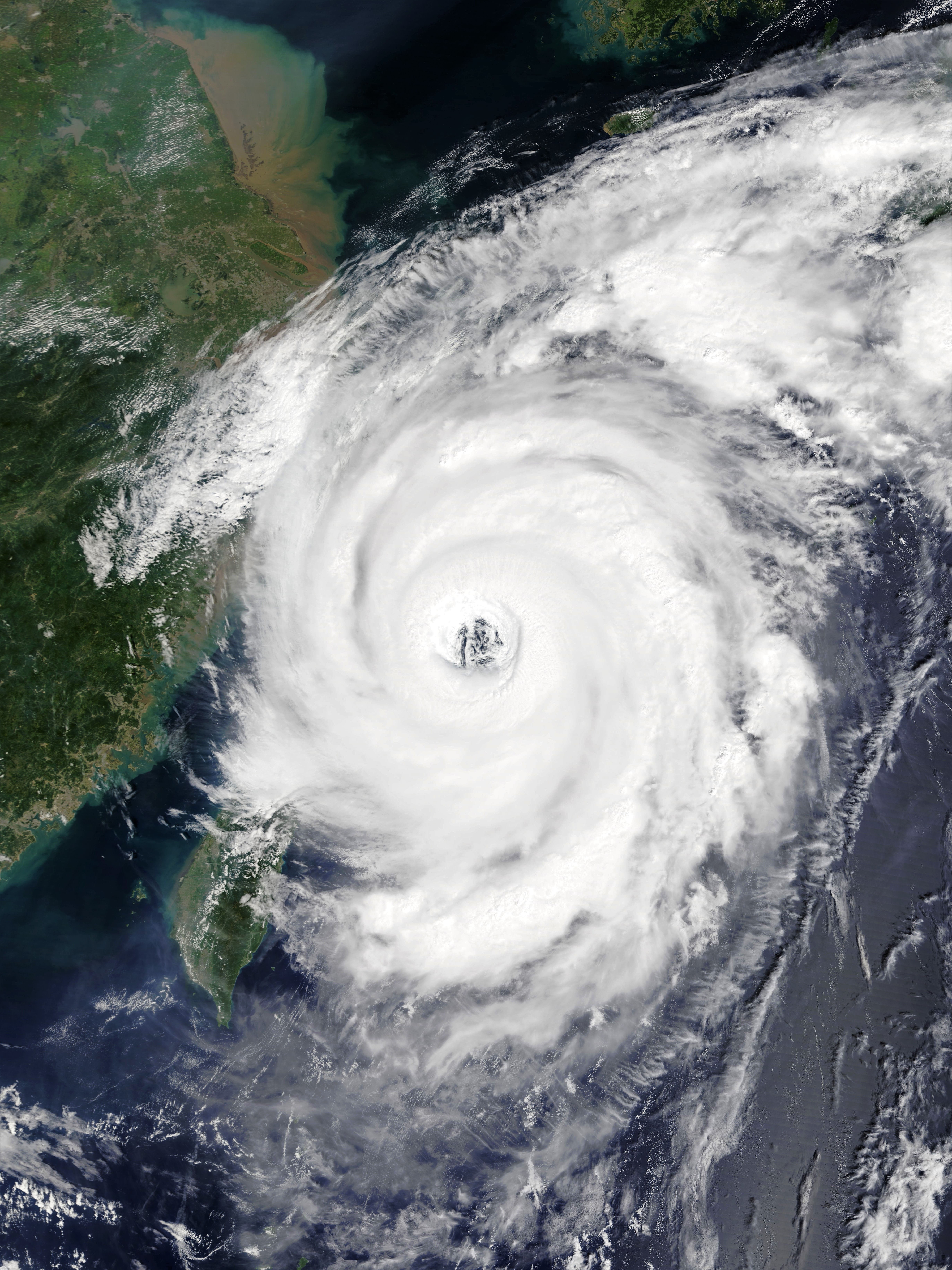
English: Typhoon Talim over the East China Sea near Shanghai at peak intensity on September 14, 2017. |
| Date | |
| Source | Rapid Response - LANCE |
| Author | MODIS image captured by NASA’s Terra satellite |
| Camera location | | View this and other nearby images on: OpenStreetMap |
|---|
Licensing
[edit]
| This file is in the public domain in the United States because it was solely created by NASA. NASA copyright policy states that "NASA material is not protected by copyright unless noted". (See Template:PD-USGov, NASA copyright policy page or JPL Image Use Policy.) | ||
 |
Warnings:
|
File history
Click on a date/time to view the file as it appeared at that time.
| Date/Time | Thumbnail | Dimensions | User | Comment | |
|---|---|---|---|---|---|
| current | 23:51, 10 June 2023 | | 5,490 × 7,320 (5.65 MB) | FooBarBaz (talk | contribs) | Reverted to version as of 02:53, 18 September 2017 (UTC) |
| 01:38, 4 May 2023 |  | 5,490 × 7,320 (7.72 MB) | Papacyclones (talk | contribs) | Reverted to version as of 05:18, 14 September 2017 (UTC) | |
| 11:09, 3 February 2018 |  | 6,400 × 8,400 (6.01 MB) | A1Cafel (talk | contribs) | 250m | |
| 02:53, 18 September 2017 |  | 5,490 × 7,320 (5.65 MB) | ChocolateTrain (talk | contribs) | Colour and lighting enhanced slightly, with all else kept identical(e.g. scale, aspect ratio, positioning) | |
| 05:18, 14 September 2017 |  | 5,490 × 7,320 (7.72 MB) | Meow (talk | contribs) | User created page with UploadWizard |
You cannot overwrite this file.
File usage on Commons
The following 4 pages use this file:
File usage on other wikis
The following other wikis use this file:
- Usage on ar.wikipedia.org
- Usage on de.wikipedia.org
- Usage on en.wikipedia.org
- Usage on ja.wikipedia.org
- Usage on ko.wikipedia.org
- Usage on pt.wikipedia.org
- Usage on ru.wikipedia.org
- Usage on th.wikipedia.org
- Usage on vi.wikipedia.org
- Usage on zh.wikipedia.org