File:Suurhusen Church, East Frisia, Germany. Pic 05.jpg
Jump to navigation
Jump to search

Size of this preview: 800 × 592 pixels. Other resolutions: 320 × 237 pixels | 640 × 473 pixels | 1,024 × 757 pixels | 1,280 × 947 pixels | 2,304 × 1,704 pixels.
Original file (2,304 × 1,704 pixels, file size: 853 KB, MIME type: image/jpeg)
Captions
Captions
Add a one-line explanation of what this file represents
| Description |
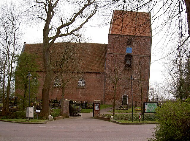
Deutsch: Schiefer Turm von Suurhusen in Ostfriesland (Deutschland)
English: Leaning Tower of Suurhusen in East Frisia, Germany |
||||
| Date | |||||
| Source | originally posted to Flickr as PICT6764 | ||||
| Author |
|
||||
| Permission (Reusing this file) |
This file is licensed under the Creative Commons Attribution-Share Alike 2.0 Generic license.
|
File history
Click on a date/time to view the file as it appeared at that time.
| Date/Time | Thumbnail | Dimensions | User | Comment | |
|---|---|---|---|---|---|
| current | 13:47, 14 March 2009 | | 2,304 × 1,704 (853 KB) | Flickr upload bot (talk | contribs) | Uploaded from http://flickr.com/photo/51758649@N00/454383503 using Flickr upload bot |
You cannot overwrite this file.
File usage on Commons
The following 4 pages use this file:
File usage on other wikis
The following other wikis use this file:
- Usage on arz.wikipedia.org
- Usage on bn.wikipedia.org
- Usage on de.wikipedia.org
- Suurhusen
- Portal:Ostfriesland
- Liste schiefer Türme
- Schiefer Turm von Suurhusen
- Portal:Ostfriesland/Kunst
- Benutzer Diskussion:Pittimann/Archiv/2014/Juli
- Liste der Baudenkmale in Hinte
- Benutzer:Aeroid/List DE NI-AUR
- Benutzer:Kpfiwa/Spielwiese/Test1
- Liste frühmittelalterlicher und romanischer Backsteinbauten
- Usage on de.wikivoyage.org
- Usage on en.wikipedia.org
- Usage on en.wikivoyage.org
- Usage on es.wikipedia.org
- Usage on fr.wikipedia.org
- Usage on hr.wikipedia.org
- Usage on hu.wikipedia.org
- Usage on it.wikipedia.org
- Usage on ja.wikipedia.org
- Usage on ro.wikipedia.org
- Usage on ru.wikipedia.org
- Usage on uk.wikipedia.org
- Usage on www.wikidata.org