File:Supposed Route of Franklin's expedition 1845-1848.svg

Original file (SVG file, nominally 999 × 700 pixels, file size: 1.6 MB)
Captions
Captions
Summary
[edit]| Description |
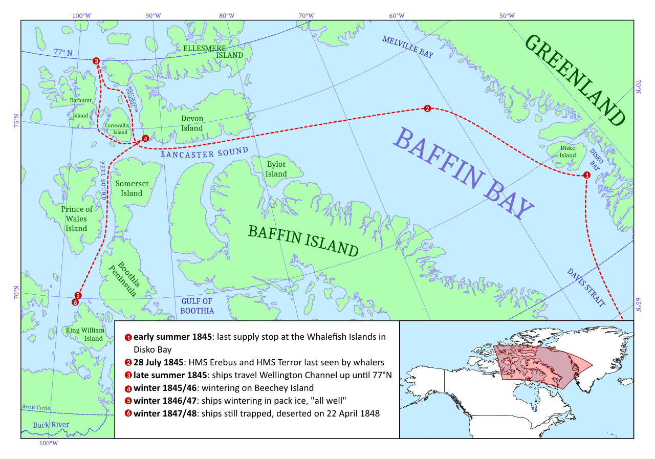
English: Map of the routes of HMS Erebus and Terror during Franklin's Expedition 1845-1845 based on first hand accounts of major waypoints. Sources:
- Meeting with whalers: The Morning Post London, Greater London, England 25 Oct 1845, Page 5 (https://www.newspapers.com/clip/24992474/sir_john_franklins_expedition/) - Route around Cornwallis Island up to 77°N, Wintering on Beechey Island, Wintering at King William Island: Victory Point Note (https://en.wikipedia.org/wiki/McClintock_Arctic_Expedition#/media/File:Franklinexpeditionnote.jpg) |
| Date | |
| Source | Own work |
| Author | Smurftrooper |
| Other versions |
|

This map contains public domain geo data from Natural Earth (Free vector and raster map data @ naturalearthdata.com.)
This map is inspired by File:Franklin's-Lost-Expedition.png and builds upon it. Especially the route around Cornwallis Island is corrected to be happening before the wintering on Beechey Island and the position of the last sighting is added.
Licensing
[edit]
- You are free:
- to share – to copy, distribute and transmit the work
- to remix – to adapt the work
- Under the following conditions:
- attribution – You must give appropriate credit, provide a link to the license, and indicate if changes were made. You may do so in any reasonable manner, but not in any way that suggests the licensor endorses you or your use.
File history
Click on a date/time to view the file as it appeared at that time.
| Date/Time | Thumbnail | Dimensions | User | Comment | |
|---|---|---|---|---|---|
| current | 11:26, 3 May 2019 | | 999 × 700 (1.6 MB) | Smurftrooper (talk | contribs) | fixed wrong date of ships desertion (22 April, Victory Point Note) |
| 13:51, 2 May 2019 |  | 999 × 700 (1.91 MB) | Smurftrooper (talk | contribs) | - added a description for the point of return at 77°N - converted labels which were text objects into paths (text-objects still hidden in file) - labels got more love in general - fixed a few visual glitches | |
| 18:48, 1 May 2019 |  | 999 × 700 (2.31 MB) | Smurftrooper (talk | contribs) | User created page with UploadWizard |
You cannot overwrite this file.
File usage on Commons
The following page uses this file:
File usage on other wikis
The following other wikis use this file:
- Usage on en.wikipedia.org
- Usage on en.wikivoyage.org