File:Stubbs Earthworks aerial view.jpg
Jump to navigation
Jump to search

Size of this preview: 800 × 530 pixels. Other resolutions: 320 × 212 pixels | 640 × 424 pixels | 1,024 × 678 pixels | 1,280 × 848 pixels | 2,424 × 1,605 pixels.
Original file (2,424 × 1,605 pixels, file size: 1.09 MB, MIME type: image/jpeg)
Captions
Captions
Add a one-line explanation of what this file represents
|
This is an image of a place or building that is listed on the National Register of Historic Places in the United States of America. Its reference number is 78002205. |
| Camera location | | View this and other nearby images on: OpenStreetMap |
|---|
| Description |
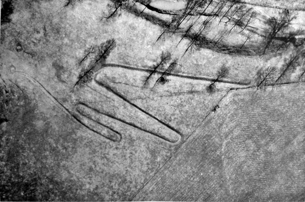
English: Aerial view of the Stubbs Earthworks, also known as the "Warren County Serpent Mound", which was formerly located on the southern side of the Little Miami River near Morrow in Washington Township, Warren County, Ohio, United States. Built by the prehistoric Hopewell culture, it is listed on the National Register of Historic Places, although most of the site has been destroyed by quarrying. |
|||
| Date | Taken on 2 March 1951 | |||
| Source | Photograph by uploader of page 22 from the Ohio Archaeologist Supplement of September 1954 | |||
| Author | Unknown author | |||
| Permission (Reusing this file) |
|

File history
Click on a date/time to view the file as it appeared at that time.
| Date/Time | Thumbnail | Dimensions | User | Comment | |
|---|---|---|---|---|---|
| current | 15:18, 4 November 2010 | | 2,424 × 1,605 (1.09 MB) | PawełMM (talk | contribs) | borders removed, contrast enhanced, desaturated to black-white |
| 02:20, 3 November 2010 |  | 2,816 × 2,112 (2.63 MB) | Nyttend (talk | contribs) | {{Location|39|21|36|N|84|10|24|W}} {{Information |Description={{en|Aerial view of the {{w|Stubbs Earthworks}}, also known as the "Warren County Serpent Mound", which was formerly located on the southern side of the {{w|Little Miami River}} near {{w|Morrow |
You cannot overwrite this file.
File usage on Commons
There are no pages that use this file.
File usage on other wikis
The following other wikis use this file:
- Usage on en.wikipedia.org