File:Stormwater management (9193).jpg
Original file (3,840 × 2,160 pixels, file size: 5.95 MB, MIME type: image/jpeg)
Captions
Captions
Summary[edit]
.jpg&action=edit§ion=1)
| Stormwater management | |
|---|---|
| Photographer |
Lance Cheung/USDA |
| Title |
Stormwater management |
| Description |
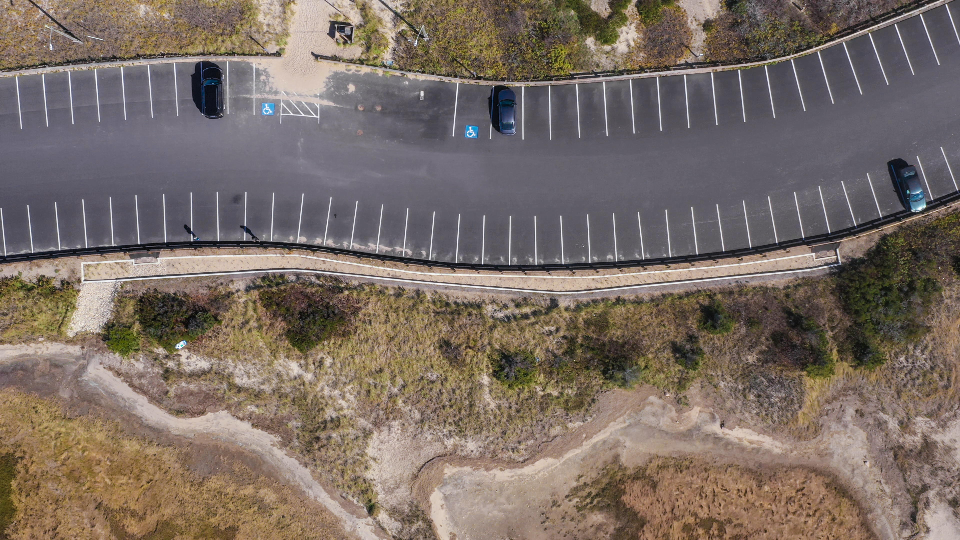
U.S. Department of Agriculture (USDA) Natural Resources and Conservation Service (NRCS) Stormwater management at this beach parking lot controls the quantity and quality of the rain and stormwater that runs off the parking lot in Town Neck Beach, Sandwich, MA, on October 10, 2019. The grade of the parking lot brings water into common channels at the ends and intermediate points. It enters a cement basin/channel where the water slows over cement ridges, rocks, and sand layers. The slower cleaner water disperses into the tidal wetlands. The process helps keeps debris and sand from entering the wildlife and shellfish habitat. Stormwater Runoff Control (NRCS Conservation Practice 570) provides control of quantity and quality of runoff caused by construction operations at development sites, and by other land-disturbing activities The purpose of this practice is to regulate the rate and amount of water runoff and sediment from development sites during and after construction operations, to minimize flooding, erosion, and sedimentation. The practice is used when there is a need to compensate for increased peak discharges and erosion resulting from construction operations at development sites or other disturbed areas needing this conservation practice. |
| Depicted place | Depicted place: Sandwich |
| Date | 14 February 2020 |
| Source | Flickr.com |
Licensing[edit]
.jpg&action=edit§ion=2)
| This image, originally posted to Flickr, was reviewed on 26 March 2024 by the administrator or reviewer Leoboudv, who confirmed that it was available on Flickr under the stated license on that date. |
This image or file is a work of a United States Department of Agriculture employee, taken or made as part of that person's official duties. As a work of the U.S. federal government, the image is in the public domain.
|
 |
File history
Click on a date/time to view the file as it appeared at that time.
| Date/Time | Thumbnail | Dimensions | User | Comment | |
|---|---|---|---|---|---|
| current | 08:02, 27 June 2023 | | 3,840 × 2,160 (5.95 MB) | Jason.nlw (talk | contribs) | pattypan 22.03 |
You cannot overwrite this file.
File usage on Commons
The following page uses this file:
.jpg)
.jpg&oldid=863538545)