File:Stollmeyer-tarsands.jpg
Jump to navigation
Jump to search
Size of this preview: 799 × 263 pixels. Other resolutions: 320 × 105 pixels | 640 × 211 pixels | 1,024 × 337 pixels | 1,280 × 422 pixels | 3,528 × 1,162 pixels.
Original file (3,528 × 1,162 pixels, file size: 3.12 MB, MIME type: image/jpeg)
Captions
Captions
Add a one-line explanation of what this file represents
Summary
[edit]
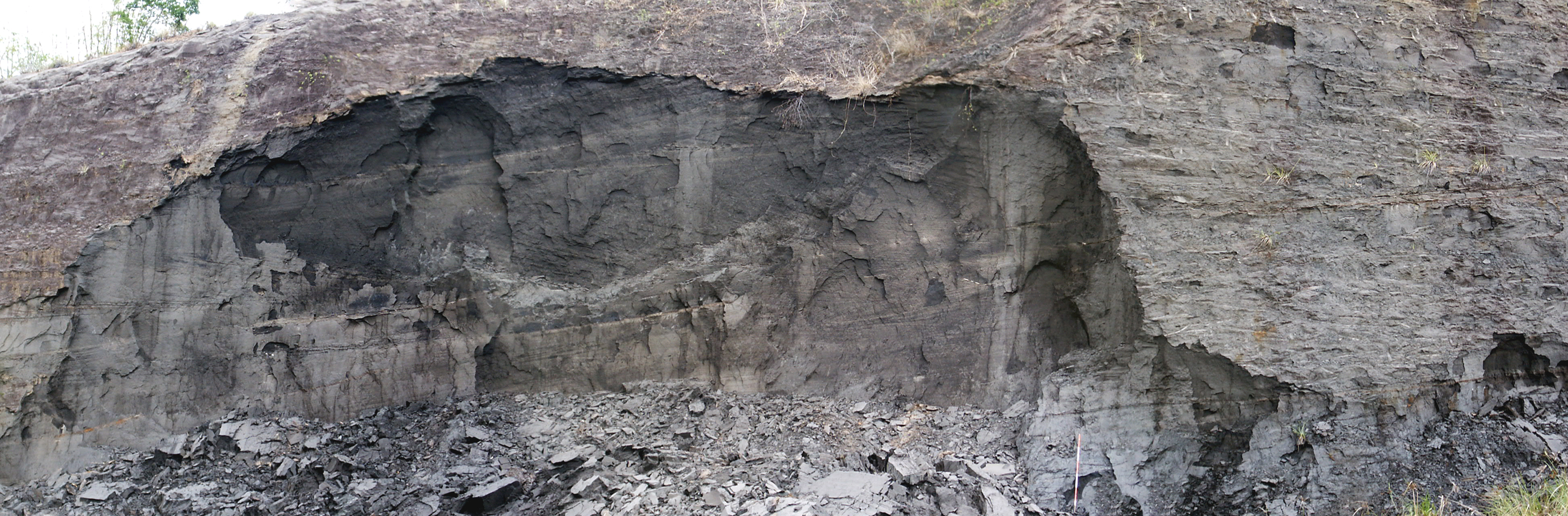
| Description | Oil sands of the lower L'Enfer Formation (Pliocene) exposed at the Stollmeyer Quarry, near Parrylands, Trinidad and Tobago. Coordinates are approximate. |
| Date | |
| Source | Own work |
| Author | Michael C. Rygel |
| Permission (Reusing this file) |
Please place my name (Michael C. Rygel) or user name (Rygel, M.C.) in a legible, clearly visible position near one of the corners of the image or in the figure caption if the image is used outside of Wikipedia or Wikimedia Commons. |
| Camera location | | View this and other nearby images on: OpenStreetMap |
|---|
Licensing
[edit]
This file is licensed under the Creative Commons Attribution-Share Alike 3.0 Unported license.
- You are free:
- to share – to copy, distribute and transmit the work
- to remix – to adapt the work
- Under the following conditions:
- attribution – You must give appropriate credit, provide a link to the license, and indicate if changes were made. You may do so in any reasonable manner, but not in any way that suggests the licensor endorses you or your use.
- share alike – If you remix, transform, or build upon the material, you must distribute your contributions under the same or compatible license as the original.
| Annotations | This image is annotated: View the annotations at Commons |
File history
Click on a date/time to view the file as it appeared at that time.
| Date/Time | Thumbnail | Dimensions | User | Comment | |
|---|---|---|---|---|---|
| current | 06:59, 26 December 2010 | 3,528 × 1,162 (3.12 MB) | Rygel, M.C. (talk | contribs) |
You cannot overwrite this file.
File usage on Commons
The following 3 pages use this file:
- User:Rygel, M.C.
- User:Rygel, M.C./gallery
- File:Stalmeyer tarsands.jpg (file redirect)
File usage on other wikis
The following other wikis use this file:
- Usage on fr.wikipedia.org
- Usage on ja.wikipedia.org
- Usage on ko.wikipedia.org
- Usage on sk.wikipedia.org