File:Stockyard Gully Cave exit in Drovers Cave National Park, Western Australia.png
Jump to navigation
Jump to search
Size of this preview: 800 × 533 pixels. Other resolutions: 320 × 213 pixels | 640 × 427 pixels | 1,024 × 683 pixels | 1,280 × 853 pixels | 2,560 × 1,707 pixels | 5,616 × 3,744 pixels.
Original file (5,616 × 3,744 pixels, file size: 20.82 MB, MIME type: image/png)
Captions
Captions
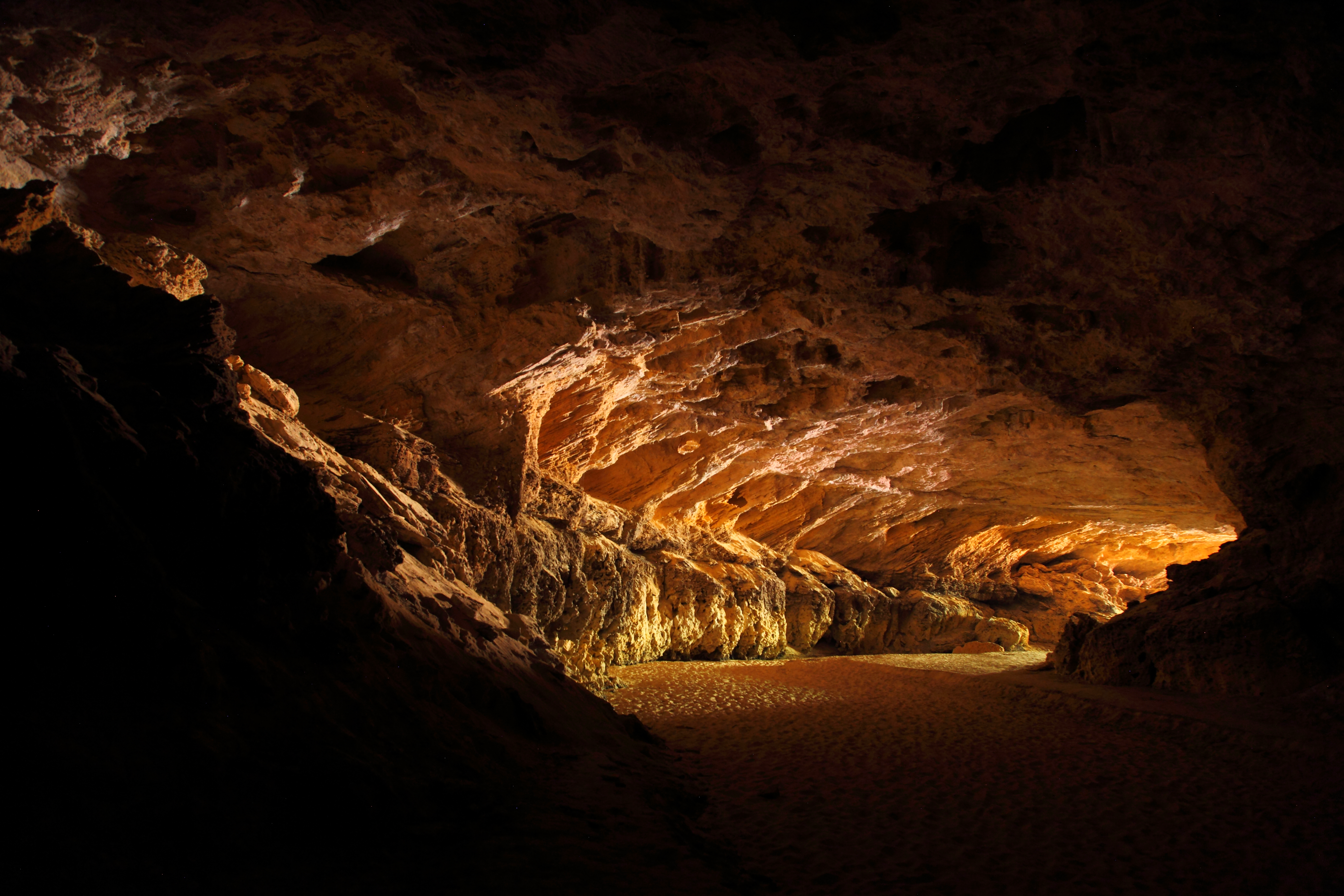
Subterranean limestone cavern 300 metres long and covered by a sandy floor, hosting bats and beehives.
Summary
[edit]
| Description |
English: Stockyard Gully Cave exit in Drovers Cave National Park, Western Australia. Subterranean limestone cavern which drains a small stream flowing westward, named after the stockmen who used the deep and cool gullies as a natural holding pen for their cattle, when droving them from Geraldton to Perth in the 1950s. 3 hours' drive north-east of Perth, and short drives from Jurien Bay and Coorow. From Jurien East Road, head north on Cockleshell Gully Road and follow the signs to the cave. |
| Date | |
| Source | Own work |
| Author | Maclearite |
| Camera location | | View this and other nearby images on: OpenStreetMap |
|---|
Licensing
[edit]
I, the copyright holder of this work, hereby publish it under the following license:
This file is licensed under the Creative Commons Attribution-Share Alike 4.0 International license.
- You are free:
- to share – to copy, distribute and transmit the work
- to remix – to adapt the work
- Under the following conditions:
- attribution – You must give appropriate credit, provide a link to the license, and indicate if changes were made. You may do so in any reasonable manner, but not in any way that suggests the licensor endorses you or your use.
- share alike – If you remix, transform, or build upon the material, you must distribute your contributions under the same or compatible license as the original.
This image was uploaded as part of Wiki Loves Earth 2022.
|
 |
File history
Click on a date/time to view the file as it appeared at that time.
| Date/Time | Thumbnail | Dimensions | User | Comment | |
|---|---|---|---|---|---|
| current | 04:22, 11 June 2022 | | 5,616 × 3,744 (20.82 MB) | Maclearite (talk | contribs) | Uploaded own work with UploadWizard |
You cannot overwrite this file.
File usage on Commons
There are no pages that use this file.