File:Stockholmskarta 1750.jpg
Jump to navigation
Jump to search

Size of this preview: 603 × 599 pixels. Other resolutions: 242 × 240 pixels | 483 × 480 pixels | 773 × 768 pixels | 1,031 × 1,024 pixels | 2,432 × 2,416 pixels.
Original file (2,432 × 2,416 pixels, file size: 3.9 MB, MIME type: image/jpeg)
Captions
Captions
Add a one-line explanation of what this file represents
Summary[edit]
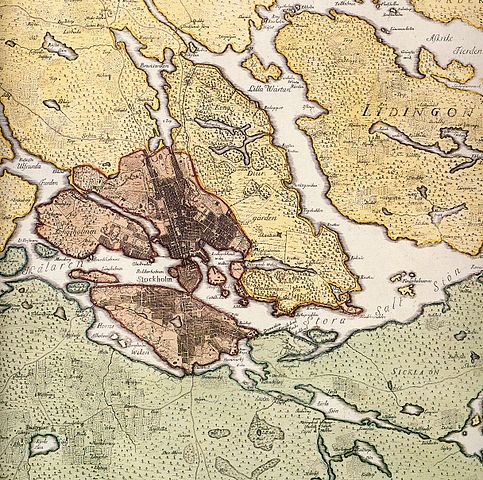
| Description | Historical map showing Stockholm, in the 18th century. The map is produced by Georg Biurman about 1750-51. |
| Date | |
| Source | Kungliga Biblioteket |
| Author | Georg Biurman |
| Permission (Reusing this file) |
yes the author is dead over 70 years |
Licensing[edit]
|
This work is in the public domain in its country of origin and other countries and areas where the copyright term is the author's life plus 100 years or fewer. | |
| This file has been identified as being free of known restrictions under copyright law, including all related and neighboring rights. | |
File history
Click on a date/time to view the file as it appeared at that time.
| Date/Time | Thumbnail | Dimensions | User | Comment | |
|---|---|---|---|---|---|
| current | 09:48, 7 March 2008 | | 2,432 × 2,416 (3.9 MB) | Holger.Ellgaard (talk | contribs) | {{Information |Description=Historical map showing Stockholm, in the 18th century. The map is produced by Georg Biurman about 1750-51. |Source=Stockholms Kartor |Date=1750 |Author=Georg Biurman |Permission=yes the author is dead over 70 years |other_versi |
You cannot overwrite this file.
File usage on Commons
The following page uses this file:
File usage on other wikis
The following other wikis use this file:
- Usage on de.wikipedia.org
- Usage on fi.wikipedia.org
- Usage on sv.wikipedia.org