File:Statehood quarters map 2009.png
Jump to navigation
Jump to search

Size of this preview: 800 × 520 pixels. Other resolutions: 320 × 208 pixels | 640 × 416 pixels | 1,024 × 665 pixels | 1,513 × 983 pixels.
Original file (1,513 × 983 pixels, file size: 61 KB, MIME type: image/png)
Captions
Captions
Add a one-line explanation of what this file represents
Summary
[edit]
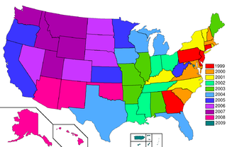
| Description | Map of Statehood quarters with the 2009 issues |
| Date | |
| Source | base map is Zntrip's blank map of US with territories; color scheme and the key is from the SVG version of this map by Cburnett. |
| Author | Hoshie |
Licensing
[edit]

|
Permission is granted to copy, distribute and/or modify this document under the terms of the GNU Free Documentation License, Version 1.2 or any later version published by the Free Software Foundation; with no Invariant Sections, no Front-Cover Texts, and no Back-Cover Texts. A copy of the license is included in the section entitled GNU Free Documentation License. |
| This file is licensed under the Creative Commons Attribution-Share Alike 3.0 Unported license. | ||
| ||
| This licensing tag was added to this file as part of the GFDL licensing update. |
File history
Click on a date/time to view the file as it appeared at that time.
| Date/Time | Thumbnail | Dimensions | User | Comment | |
|---|---|---|---|---|---|
| current | 13:15, 15 December 2011 | | 1,513 × 983 (61 KB) | Mayhaymate (talk | contribs) | Optimized with PNGOUT |
| 06:37, 2 June 2008 |  | 1,513 × 983 (77 KB) | Hoshie (talk | contribs) | {{Information |Description=Map of Statehood quarters with the 2009 issues |Source=base map is Zntrip's blank map of Wales; color and the key is from the [[:Image:State Quarters Year Map.svg|SVG |
You cannot overwrite this file.
File usage on Commons
The following page uses this file: