File:Stadtplan Breslau 1904.jpg
Jump to navigation
Jump to search

Size of this preview: 742 × 599 pixels. Other resolutions: 297 × 240 pixels | 594 × 480 pixels | 951 × 768 pixels | 1,268 × 1,024 pixels | 2,536 × 2,048 pixels | 3,370 × 2,722 pixels.
Original file (3,370 × 2,722 pixels, file size: 9.94 MB, MIME type: image/jpeg)
Captions
Captions
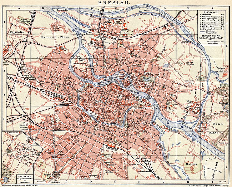
1904 Brockhaus' map of Wrocław (Breslau)
Summary
[edit]
| Description |
Čeština: Brockhausova mapa Vratislavi z roku 1904
English: 1904 Brockhaus' map of Wrocław (Breslau)
Deutsch: Brockhaus-Stadtplan von Breslau aus dem Jahr 1904
Polski: Plan Wrocławia wydawnictwa Brockhaus z roku 1904 |
| Date | |
| Source | F.A. Brockhaus' Geogr-artist. Anstalt Leipzig |
| Author | F.A. Brockhaus' Geogr-artist. Anstalt Leipzig |
Licensing
[edit]
|
This work is in the public domain in its country of origin and other countries and areas where the copyright term is the author's life plus 70 years or fewer. This work is in the public domain in the United States because it was published (or registered with the U.S. Copyright Office) before January 1, 1929. | |
| This file has been identified as being free of known restrictions under copyright law, including all related and neighboring rights. | |
File history
Click on a date/time to view the file as it appeared at that time.
| Date/Time | Thumbnail | Dimensions | User | Comment | |
|---|---|---|---|---|---|
| current | 17:52, 30 October 2021 | | 3,370 × 2,722 (9.94 MB) | Gaj777 (talk | contribs) | Uploaded a work by Brockhaus Konversation-Lexikon, 14. Auflage from Brockhaus Konversation-Lexikon, 14. Auflage with UploadWizard |
You cannot overwrite this file.
File usage on Commons
The following 2 pages use this file:
File usage on other wikis
The following other wikis use this file:
- Usage on cs.wikipedia.org