File:St Pauls Monastery Jarrow2.jpg
Jump to navigation
Jump to search
No higher resolution available.
St_Pauls_Monastery_Jarrow2.jpg (640 × 480 pixels, file size: 75 KB, MIME type: image/jpeg)
Captions
Captions
Add a one-line explanation of what this file represents
Summary[edit]
| Description |
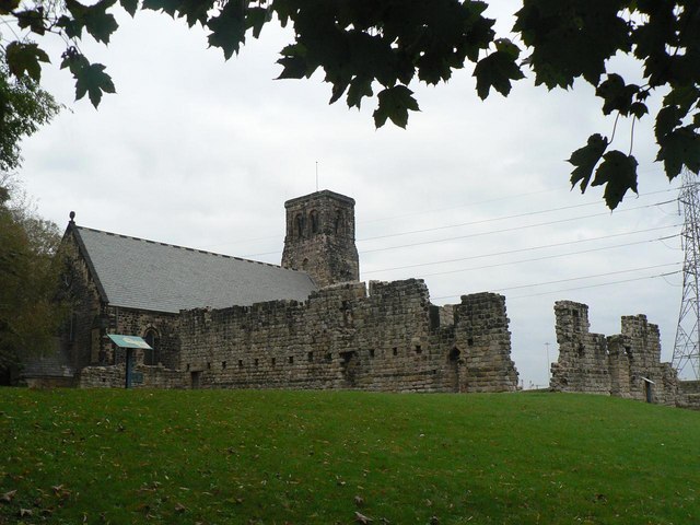
English: Jarrow, Tyne and Wear. The surviving wall of the west range of St Paul's Monastery, with St Paul's parish church beyond. |
| Date | |
| Source | From geograph.org.uk |
| Author | Chris Downer |
| Permission (Reusing this file) |
Creative Commons Attribution Share-alike license 2.0 |
| Camera location | | View this and other nearby images on: OpenStreetMap |
|---|
Licensing[edit]

|
This image was taken from the Geograph project collection. See this photograph's page on the Geograph website for the photographer's contact details. The copyright on this image is owned by Chris Downer and is licensed for reuse under the Creative Commons Attribution-ShareAlike 2.0 license.
|
This file is licensed under the Creative Commons Attribution-Share Alike 2.0 Generic license.
Attribution: Chris Downer
- You are free:
- to share – to copy, distribute and transmit the work
- to remix – to adapt the work
- Under the following conditions:
- attribution – You must give appropriate credit, provide a link to the license, and indicate if changes were made. You may do so in any reasonable manner, but not in any way that suggests the licensor endorses you or your use.
- share alike – If you remix, transform, or build upon the material, you must distribute your contributions under the same or compatible license as the original.
File history
Click on a date/time to view the file as it appeared at that time.
| Date/Time | Thumbnail | Dimensions | User | Comment | |
|---|---|---|---|---|---|
| current | 15:31, 9 August 2008 | | 640 × 480 (75 KB) | Kurpfalzbilder.de (talk | contribs) | {{Information |Description=Jarrow: remains of monastery |Source=From [http://www.geograph.org.uk/photo/595992 geograph.org.uk] |Date=2007-10-24 |Author=[http://www.geograph.org.uk/profile/14700 Chris Downer] |Permission=Creative Commons Attribution Share- |
You cannot overwrite this file.
File usage on Commons
There are no pages that use this file.
File usage on other wikis
The following other wikis use this file:
- Usage on ca.wikipedia.org
- Usage on fr.wikipedia.org
- Usage on pt.wikipedia.org
- Usage on tr.wikipedia.org
- Usage on uk.wikipedia.org