File:St-h-anaglyph-x (ASTER).jpg
Jump to navigation
Jump to search
Size of this preview: 531 × 599 pixels. Other resolutions: 213 × 240 pixels | 425 × 480 pixels | 681 × 768 pixels | 1,200 × 1,354 pixels.
Original file (1,200 × 1,354 pixels, file size: 488 KB, MIME type: image/jpeg)
Captions
Captions
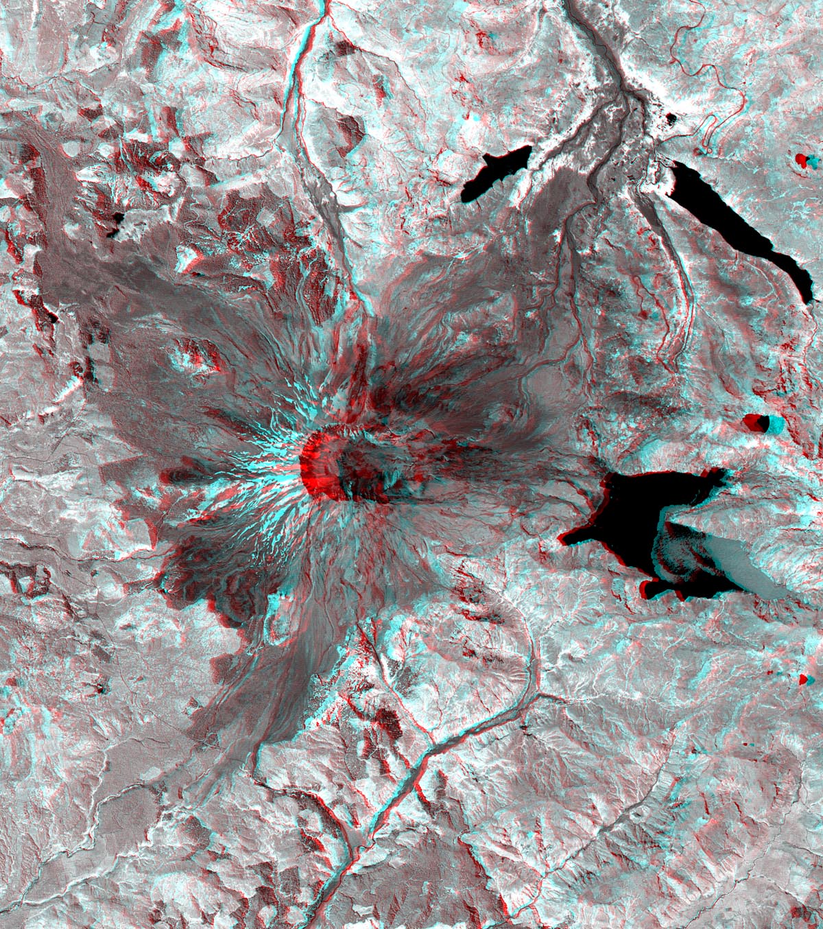
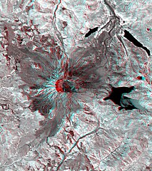
TOP LEFT: This ASTER image of Mt. St. Helens volcano in Washington was acquired on August 8, 2000 and covers an area of 37 by 51 km.
Summary[edit]
| Description |
English: TOP LEFT: This ASTER image of Mt. St. Helens volcano in Washington was acquired on August 8, 2000 and covers an area of 37 by 51 km. Mount Saint Helens, a volcano in the Cascade Range of southwestern Washington that had been dormant since 1857, began to show signs of renewed activity in early 1980. On 18 May 1980, it erupted with such violence that the top of the mountain was blown off, spewing a cloud of ash and gases that rose to an altitude of 19 kilometers. The blast killed about 60 people and destroyed all life in an area of some 180 square kilometers (some 70 square miles), while a much larger area was covered with ash and debris. It continues to spit forth ash and steam intermittently. As a result of the eruption, the mountain's elevation decreased from 2,950 meters to 2,549 meters. The image is centered at 46.2 degrees north latitude, 122.2 degrees west longitude. TOP RIGHT: This 3-D anaglyph image of Mt. St. Helens volcano combines the nadir-looking and back-looking band 3 images of ASTER. To view the image in stereo, you will need blue-red glasses. Make sure to look through the red lens with your left eye. BOTTOM LEFT: The simulated fly-over was produced by draping ASTER visible and near infrared image data over a digital topography model, created from ASTER's 3-D stereo bands. The color was computer enhanced to create a natural color image, where the vegetation appears green. The topography has been exaggerated 2 times to enhance the appearance of the relief. |
||
| Date | Taken on 8 August 2000 | ||
| Source |
|
||
| Author | NASA/METI/AIST/Japan Space Systems, and U.S./Japan ASTER Science Team | ||
| Other versions |
|
.jpg)
.jpg&action=edit§ion=1)
| Object location | | View this and other nearby images on: OpenStreetMap |
|---|
.jpg¶ms=046.200000_N_-122.200000_E_globe:Earth_class:object_type:object__&language=en)
| This media is a product of the Terra mission Credit and attribution belongs to the Advanced Spaceborne Thermal Emission and Reflection Radiometer (ASTER) team, NASA/METI/AIST/Japan Space Systems |
Licensing[edit]
.jpg&action=edit§ion=2)
| This file is in the public domain in the United States because it was solely created by NASA. NASA copyright policy states that "NASA material is not protected by copyright unless noted". (See Template:PD-USGov, NASA copyright policy page or JPL Image Use Policy.) | ||
 |
Warnings:
|
File history
Click on a date/time to view the file as it appeared at that time.
| Date/Time | Thumbnail | Dimensions | User | Comment | |
|---|---|---|---|---|---|
| current | 21:13, 30 December 2023 | | 1,200 × 1,354 (488 KB) | OptimusPrimeBot (talk | contribs) | #Spacemedia - Upload of https://asterweb.jpl.nasa.gov/gallery/images/st-h-anaglyph-x.jpg via Commons:Spacemedia |
You cannot overwrite this file.
File usage on Commons
The following page uses this file:
.jpg&oldid=836934770)