File:Sri Lanka COVID-19 Deaths by district.svg
Jump to navigation
Jump to search

Size of this PNG preview of this SVG file: 393 × 599 pixels. Other resolutions: 157 × 240 pixels | 315 × 480 pixels | 503 × 768 pixels | 671 × 1,024 pixels | 1,342 × 2,048 pixels | 512 × 781 pixels.
Original file (SVG file, nominally 512 × 781 pixels, file size: 83 KB)
Captions
Captions
Add a one-line explanation of what this file represents
Summary[edit]
| Description |
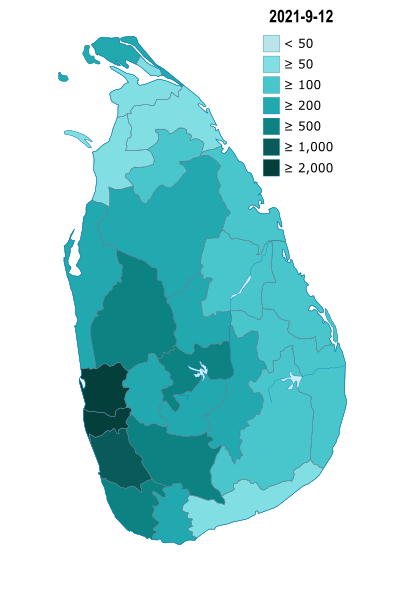
English: Map of districts and territories in the Sri Lanka with number of deaths cases as of November 28, 2020 |
| Date | |
| Source | Own work |
| Author | Mithila Madawa Gunathilake |
| SVG development | This map was created with Adobe Illustrator. |
Licensing[edit]
I, the copyright holder of this work, hereby publish it under the following licenses:

|
Permission is granted to copy, distribute and/or modify this document under the terms of the GNU Free Documentation License, Version 1.2 or any later version published by the Free Software Foundation; with no Invariant Sections, no Front-Cover Texts, and no Back-Cover Texts. A copy of the license is included in the section entitled GNU Free Documentation License. |
This file is licensed under the Creative Commons Attribution-Share Alike 4.0 International, 3.0 Unported, 2.5 Generic, 2.0 Generic and 1.0 Generic license.
- You are free:
- to share – to copy, distribute and transmit the work
- to remix – to adapt the work
- Under the following conditions:
- attribution – You must give appropriate credit, provide a link to the license, and indicate if changes were made. You may do so in any reasonable manner, but not in any way that suggests the licensor endorses you or your use.
- share alike – If you remix, transform, or build upon the material, you must distribute your contributions under the same or compatible license as the original.
You may select the license of your choice.
File history
Click on a date/time to view the file as it appeared at that time.
| Date/Time | Thumbnail | Dimensions | User | Comment | |
|---|---|---|---|---|---|
| current | 12:30, 22 September 2021 | | 512 × 781 (83 KB) | Mithila Madawa Gunathilake (talk | contribs) | Update new map 9.22 |
| 14:11, 10 May 2021 |  | 512 × 781 (78 KB) | Mithila Madawa Gunathilake (talk | contribs) | Update and colour change | |
| 13:51, 24 January 2021 |  | 512 × 781 (78 KB) | Mithila Madawa Gunathilake (talk | contribs) | Update new version v5.6 (Build 177) | |
| 16:20, 17 January 2021 |  | 512 × 781 (76 KB) | Mithila Madawa Gunathilake (talk | contribs) | Update new version v5.5 (Build 169) | |
| 01:56, 17 January 2021 |  | 512 × 781 (76 KB) | Mithila Madawa Gunathilake (talk | contribs) | Update new version v5.4 (Build 168) Fixed | |
| 01:04, 17 January 2021 |  | 512 × 781 (76 KB) | Mithila Madawa Gunathilake (talk | contribs) | Update new version v5.3 (Build 167) 16-01-2021 | |
| 06:21, 10 January 2021 |  | 512 × 781 (76 KB) | Mithila Madawa Gunathilake (talk | contribs) | Update new version v5.2 (Build 160) (Deaths by district 9th Jan 2021) | |
| 12:24, 1 January 2021 |  | 512 × 781 (77 KB) | Mithila Madawa Gunathilake (talk | contribs) | Edit & update map (effect 30th December 2020) v5.1 (Build 149) | |
| 18:03, 19 December 2020 |  | 512 × 781 (75 KB) | Mithila Madawa Gunathilake (talk | contribs) | Change colour and update map | |
| 19:51, 12 December 2020 |  | 512 × 781 (75 KB) | Mithila Madawa Gunathilake (talk | contribs) | Update New Map (12/12/2020) v3.0 |
You cannot overwrite this file.
File usage on Commons
There are no pages that use this file.
File usage on other wikis
The following other wikis use this file:
- Usage on fa.wikipedia.org
- Usage on jv.wikipedia.org
- Usage on ur.wikipedia.org
- Usage on vi.wikipedia.org