File:Spain Canary Islands location map with Spain.png
Jump to navigation
Jump to search

Size of this preview: 799 × 355 pixels. Other resolutions: 320 × 142 pixels | 640 × 284 pixels | 1,474 × 655 pixels.
Original file (1,474 × 655 pixels, file size: 56 KB, MIME type: image/png)
Captions
Captions
Add a one-line explanation of what this file represents
| Description |
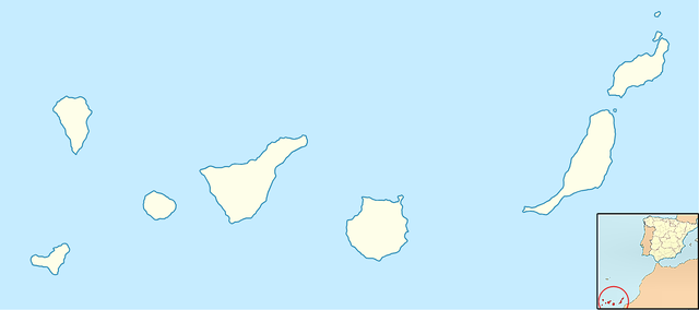
Quadratische Plattkarte, N-S-Streckung 110 %. Geographische Begrenzung der Karte: * N: 29.5° N * S: 27.4° N * W: 18.4° W * O: 13.2° W Equirectangular projection, N/S stretching 110 %. Geographic limits of the map: * N: 29.5° N * S: 27.4° N * W: 18.4° W * E: 13.2° W
English: Map of Spain with Canary Islands highlighted. Español: Localización de Canarias respecto a España. |
| Date | (UTC) |
| Source | |
| Author |
| This is a retouched picture, which means that it has been digitally altered from its original version. The original can be viewed here: Mapa territorios España Canarias.svg:
|
This file is licensed under the Creative Commons Attribution-Share Alike 3.0 Unported license.
- You are free:
- to share – to copy, distribute and transmit the work
- to remix – to adapt the work
- Under the following conditions:
- attribution – You must give appropriate credit, provide a link to the license, and indicate if changes were made. You may do so in any reasonable manner, but not in any way that suggests the licensor endorses you or your use.
- share alike – If you remix, transform, or build upon the material, you must distribute your contributions under the same or compatible license as the original.
Original upload log
[edit]
This image is a derivative work of the following images:
- File:Spain_Canary_Islands_location_map.svg licensed with Cc-by-sa-3.0, GFDL
- 2008-08-29T08:36:19Z NordNordWest 1475x655 (29529 Bytes)
- 2008-08-10T18:55:18Z NordNordWest 492x218 (34183 Bytes) {{Information |Description= {{de|Positionskarte der [[Kanarische Inseln|Kanarischen Inseln]], [[:de:Spanien|Spanien]]}} Quadratische Plattkarte, N-S-Streckung 110 %. Geographische Begrenzung der Karte: * N: 29.5° N * S: 27.4
- File:Mapa_territorios_España_Canarias.svg licensed with Cc-by-sa-3.0,2.5,2.0,1.0, GFDL
- 2008-04-25T15:35:22Z HansenBCN 975x653 (1465869 Bytes) +corrección
- 2008-04-25T15:32:05Z HansenBCN 975x653 (1465852 Bytes) corrección del sombreado de costas
- 2008-04-25T15:28:32Z HansenBCN 975x653 (1465907 Bytes) == Summary == {{Information |Description=Ejemplo de mapas de localización para España, ampliando la visión a las Islas Canarias. Los colores de esta versión se ajustan a otros mapas para Wikipedia, recomendados por el ''[
Uploaded with derivativeFX
File history
Click on a date/time to view the file as it appeared at that time.
| Date/Time | Thumbnail | Dimensions | User | Comment | |
|---|---|---|---|---|---|
| current | 14:42, 1 April 2010 | | 1,474 × 655 (56 KB) | Basilicofresco (talk | contribs) | {{Information |Description={{de|Positionskarte der Kanarischen Inseln, Spanien}} Quadratische Plattkarte, N-S-Streckung 110 %. Geographische Begrenzung der Karte: * N: 29.5° N * S: 27.4° N * W: 18.4° W * O: 13.2° |
You cannot overwrite this file.
File usage on Commons
The following page uses this file:
File usage on other wikis
The following other wikis use this file:
- Usage on eo.wikipedia.org
- Usage on fy.wikipedia.org
- Usage on it.wikipedia.org
- Valverde (Spagna)
- Las Palmas de Gran Canaria
- Adeje
- Agaete
- Agüimes
- Agulo
- Alajeró
- Arafo
- Antigua (Spagna)
- Arico
- Arona (Spagna)
- Arrecife
- Betancuria
- Breña Alta
- Breña Baja
- Buenavista del Norte
- Artenara
- Arucas
- Candelaria (Spagna)
- Barlovento
- Gáldar
- Garachico
- Garafía
- Granadilla de Abona
- Guía de Isora
- Güímar
- Haría
- Hermigua
- Icod de los Vinos
- Ingenio (Spagna)
- La Guancha
- La Matanza de Acentejo
- La Oliva
- La Orotava
- La Victoria de Acentejo
- Los Llanos de Aridane
- Los Realejos
- Los Silos
- Mogán
- El Paso (Spagna)
- El Rosario (Spagna)
- El Sauzal
- El Tanque
- Fasnia
- Firgas
- La Frontera (Santa Cruz de Tenerife)
- Fuencaliente de la Palma
View more global usage of this file.