File:Southern Indonesia (MODIS).jpg

Original file (1,352 × 1,097 pixels, file size: 116 KB, MIME type: image/jpeg)
Captions
Captions
Summary[edit]
.jpg&action=edit§ion=1)
| Description |
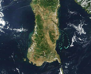
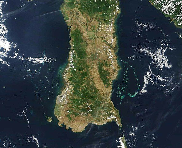
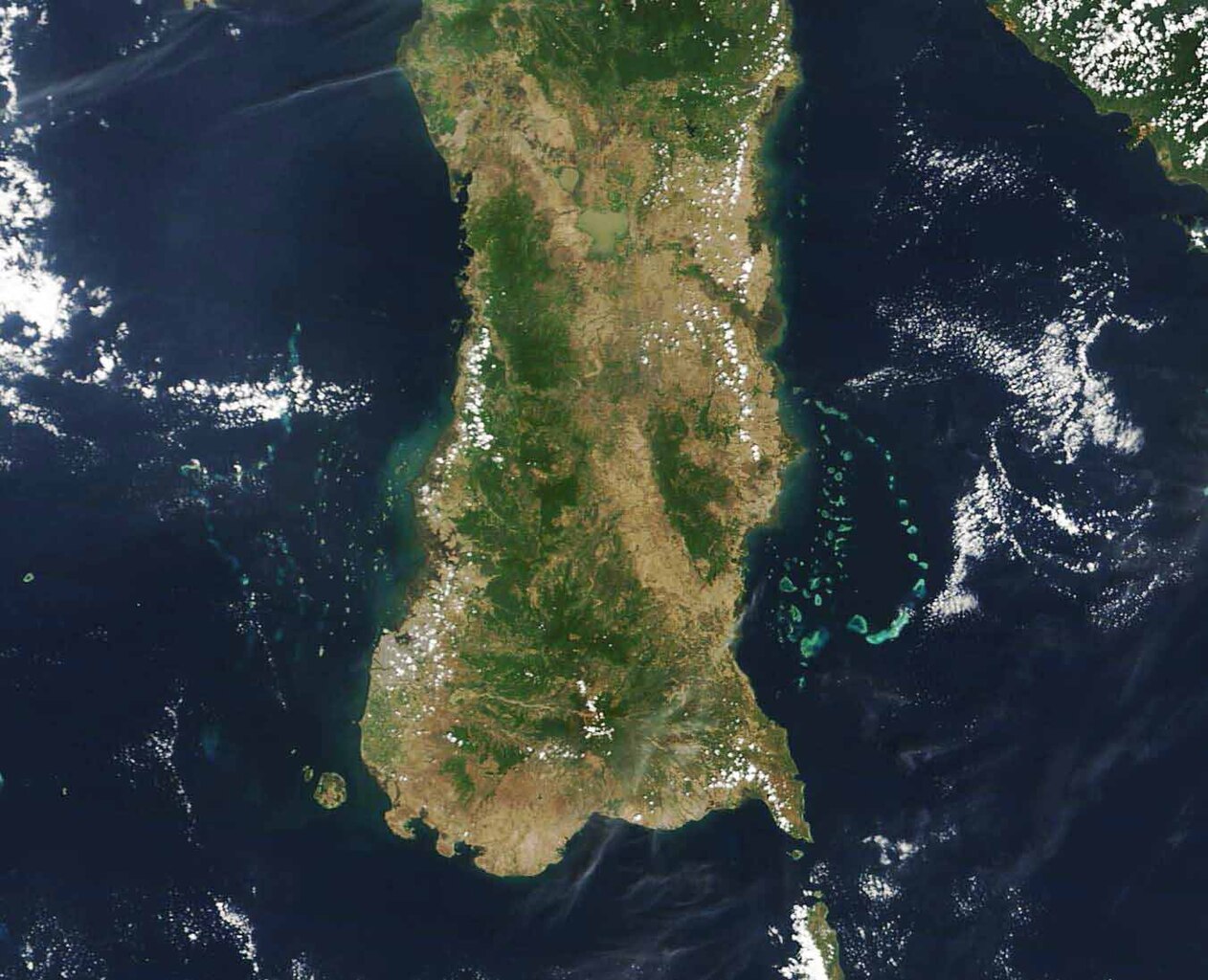
English: Indonesia sits in a notoriously cloudy region of the globe, making it difficult to see the region from space. An unusual patch of clear skies on November 13, 2023, allowed the Moderate Resolution Imaging Spectroradiometer (MODIS) on NASA’s Terra satellite to capture a beautiful true-color image of the southern peninsula of Sulawesi, Indonesia.
Indonesia is an island archipelago located between the Indian Ocean and Pacific Ocean in Southeast Asia. The country consists of five main islands (Sumatra, Java, Kalimantan, Sulawesi, and Papua) which are surrounded by about 30 smaller archipelagos. In total, there are about 18,110 islands and islets. With a land area of about 174,600 square kilometers 67,413 square miles), Sulawesi is the world’s 11th largest island and home to more than 20 million people. Made up of four peninsulas, Sulawesi looks like a giant letter “K” and sits in deep water—sea depth reaches up to 15,000 near the island. The island hosts a remarkable diversity of terrestrial flora and fauna, with species of both Asian and Australasian ancestry. According to Mongabay, of 127 known mammals, 72 are endemic (known only on the island) and 34 percent of Sulawesi’s nearly 1,500 bird species are endemic. |
||
| Date | Taken on 13 November 2023 | ||
| Source |
Southern Indonesia (direct link)
|
||
| Author | MODIS Land Rapid Response Team, NASA GSFC |
| This media is a product of the Terra mission Credit and attribution belongs to the mission team, if not already specified in the "author" row |
Licensing[edit]
.jpg&action=edit§ion=2)
| This file is in the public domain in the United States because it was solely created by NASA. NASA copyright policy states that "NASA material is not protected by copyright unless noted". (See Template:PD-USGov, NASA copyright policy page or JPL Image Use Policy.) | ||
 |
Warnings:
|
File history
Click on a date/time to view the file as it appeared at that time.
| Date/Time | Thumbnail | Dimensions | User | Comment | |
|---|---|---|---|---|---|
| current | 05:05, 26 November 2023 | | 1,352 × 1,097 (116 KB) | OptimusPrimeBot (talk | contribs) | #Spacemedia - Upload of http://modis.gsfc.nasa.gov/gallery/images/image11262023_250m.jpg via Commons:Spacemedia |
You cannot overwrite this file.
File usage on Commons
There are no pages that use this file.
.jpg&oldid=825273651)