File:Southern Gondwana.png
Jump to navigation
Jump to search

Size of this preview: 794 × 599 pixels. Other resolutions: 318 × 240 pixels | 636 × 480 pixels | 1,018 × 768 pixels | 1,280 × 966 pixels | 2,560 × 1,932 pixels | 3,997 × 3,017 pixels.
Original file (3,997 × 3,017 pixels, file size: 1.95 MB, MIME type: image/png)
Captions
Captions
Add a one-line explanation of what this file represents
Summary
[edit]
| Description |
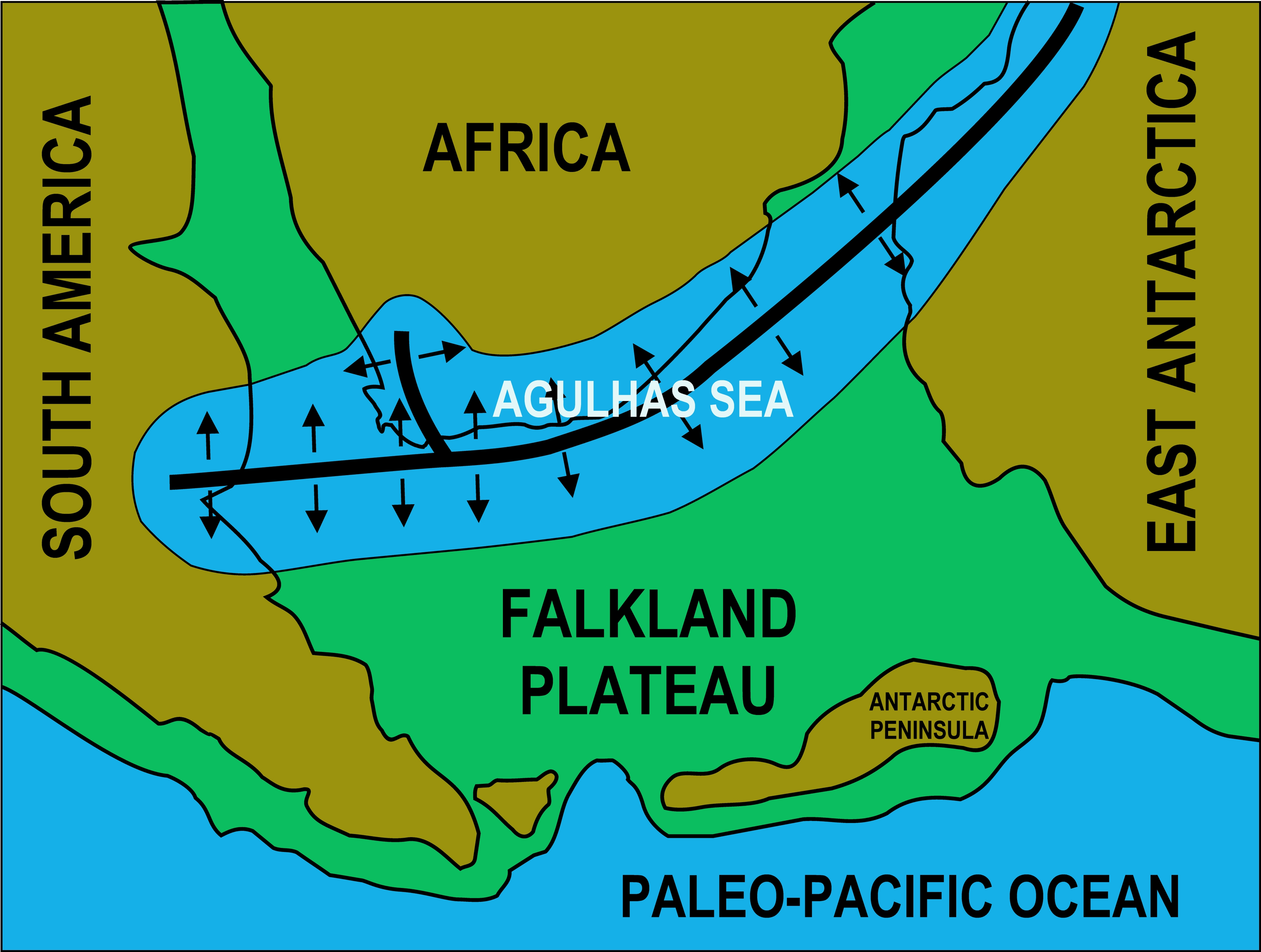
English: The southern portion of Gondwana soon after its assembly. A rift appeared as indicated by the thick black line about 500 mya. This flooded to form the Agulhas Sea. This sea filled with sedimenst that were to become the Cape Supergroup, which subsequently were folded into the Cape Fold Belt |
| Date | |
| Source | Own work |
| Author | Oggmus |
Licensing
[edit]
I, the copyright holder of this work, hereby publish it under the following license:
This file is licensed under the Creative Commons Attribution-Share Alike 3.0 Unported license.
- You are free:
- to share – to copy, distribute and transmit the work
- to remix – to adapt the work
- Under the following conditions:
- attribution – You must give appropriate credit, provide a link to the license, and indicate if changes were made. You may do so in any reasonable manner, but not in any way that suggests the licensor endorses you or your use.
- share alike – If you remix, transform, or build upon the material, you must distribute your contributions under the same or compatible license as the original.
File history
Click on a date/time to view the file as it appeared at that time.
| Date/Time | Thumbnail | Dimensions | User | Comment | |
|---|---|---|---|---|---|
| current | 09:02, 11 March 2016 | | 3,997 × 3,017 (1.95 MB) | Oggmus (talk | contribs) | addition important detail, not in previous version. |
| 12:46, 23 March 2014 |  | 5,660 × 4,265 (575 KB) | Oggmus (talk | contribs) | User created page with UploadWizard |
You cannot overwrite this file.
File usage on Commons
There are no pages that use this file.
File usage on other wikis
The following other wikis use this file:
- Usage on ca.wikipedia.org
- Usage on en.wikipedia.org
- Usage on es.wikipedia.org
- Usage on fr.wikipedia.org
- Usage on it.wikipedia.org
- Usage on nl.wikipedia.org
- Usage on uk.wikipedia.org