File:Southern Europe (MODIS 2016-11-01).jpg
Original file (4,897 × 4,153 pixels, file size: 2.43 MB, MIME type: image/jpeg)
Captions
Captions
Summary[edit]
.jpg&action=edit§ion=1)
| Description |
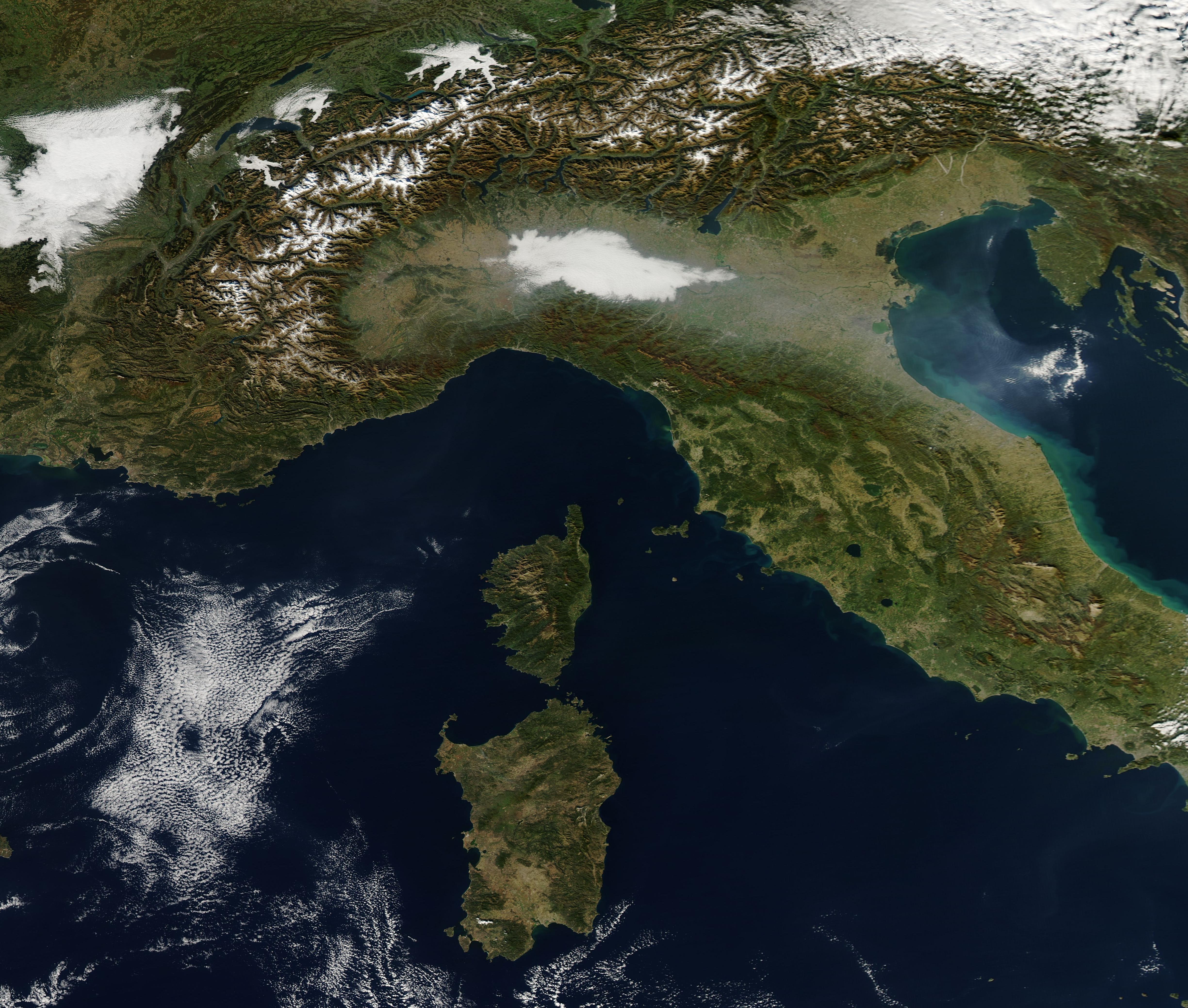
English: On October 30, 2016, the Moderate Resolution Imaging Spectroradiometer (MODIS) aboard NASA’s Aqua satellite flew over southern Europe and acquired this true-color image.
The image centers on Northern Italy and the Mediterranean Sea. Two large, green islands sit in the blue waters of the Mediterranean Sea. Although situated closely together, the islands belong to two different countries. The largest island is Sardegna (Sardinia), Italy, while the smaller, more northerly island is Corsica, France. The snow-covered Alps run from west to east across the northern section of the image, extending more about 750 miles (1,200 km). Eight countries share this mountainous terrain, including Monaco, France, Switzerland, Liechtenstein, Austria, Germany, Slovenia and, to the south, Italy. Fog and haze hang in Italy’s Po River Valley south of the Alps. In cool weather early morning fog often collects in the Po River Valley (also known as Padana Plains or Pianura Padana). Fog typically appears bright white in MODIS images and,like clouds, often forms fairly large banks. Smog or haze, however, typically appears gray or blue-gray and often appears thinner and more veil-like than thicker fog. The Po Valley contains the highest population density in Italy and produces large amounts of pollutants from vehicles, factories, coal-fired power plants, agricultural fires and other human activities. In fall and winter, temperature inversions often trap both fog and pollutants near the surface of this valley. |
||
| Date | Taken on 20 October 2016 | ||
| Source |
|
||
| Author | Jeff Schmaltz, MODIS Land Rapid Response Team, NASA GSFC |
| This media is a product of the Aqua mission Credit and attribution belongs to the mission team, if not already specified in the "author" row |
Licensing[edit]
.jpg&action=edit§ion=2)
| This file is in the public domain in the United States because it was solely created by NASA. NASA copyright policy states that "NASA material is not protected by copyright unless noted". (See Template:PD-USGov, NASA copyright policy page or JPL Image Use Policy.) | ||
 |
Warnings:
|
File history
Click on a date/time to view the file as it appeared at that time.
| Date/Time | Thumbnail | Dimensions | User | Comment | |
|---|---|---|---|---|---|
| current | 19:15, 15 February 2024 | | 4,897 × 4,153 (2.43 MB) | OptimusPrimeBot (talk | contribs) | #Spacemedia - Upload of http://modis.gsfc.nasa.gov/gallery/images/image11012016_250m.jpg via Commons:Spacemedia |
You cannot overwrite this file.
File usage on Commons
There are no pages that use this file.
.jpg&oldid=852066124)