File:South Humberside former postal county.svg
Jump to navigation
Jump to search

Size of this PNG preview of this SVG file: 752 × 394 pixels. Other resolutions: 320 × 168 pixels | 640 × 335 pixels | 1,024 × 537 pixels | 1,280 × 671 pixels | 2,560 × 1,341 pixels.
Original file (SVG file, nominally 752 × 394 pixels, file size: 312 KB)
Captions
Captions
Add a one-line explanation of what this file represents
Summary[edit]
| Description | |
| Date | |
| Source |
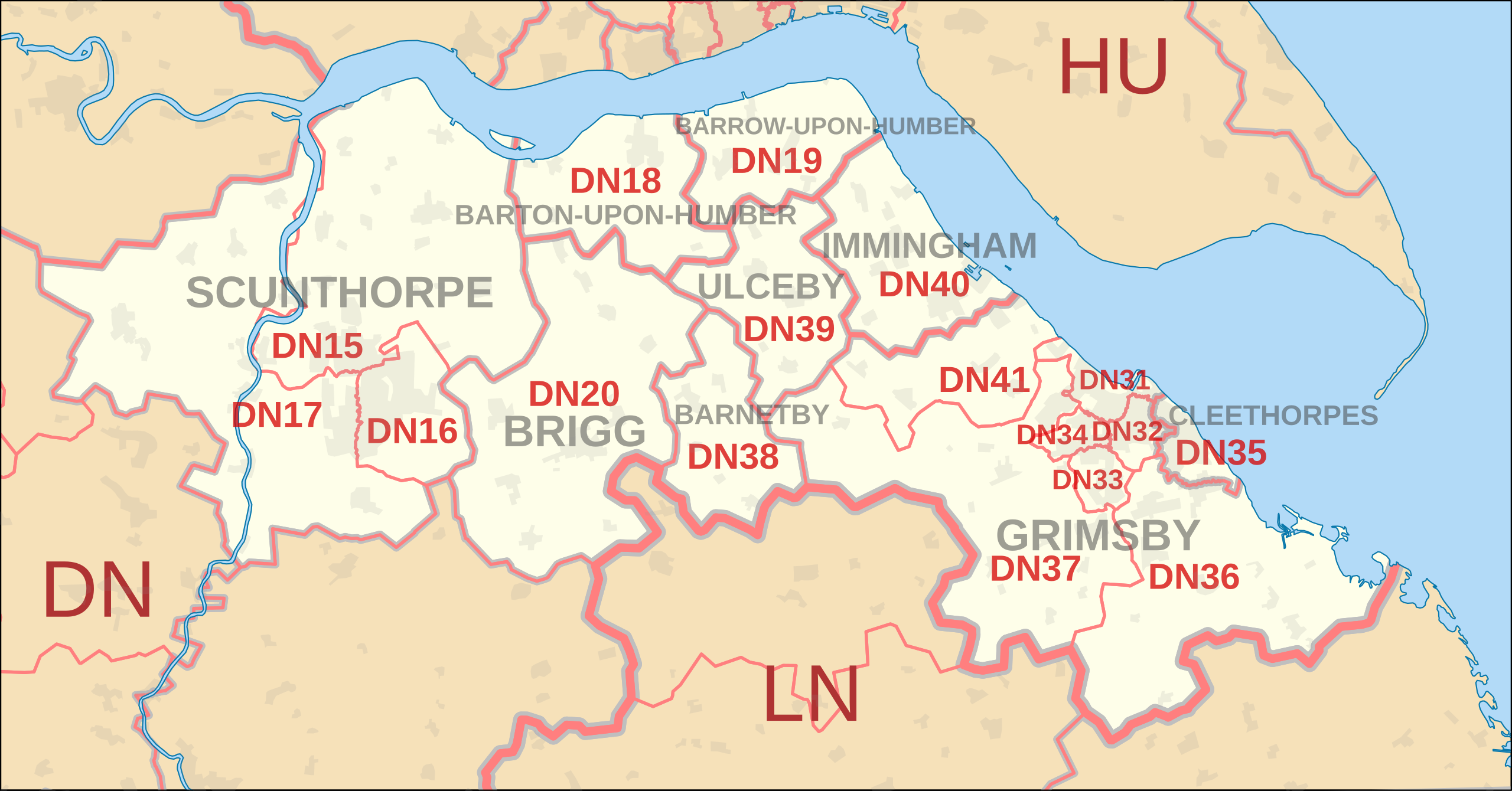
This file was derived from: DN postcode area map.svg: |
| Author |
|
References[edit]
- Former postal county boundaries derived from Postal counties of the United Kingdom, revision as of 15:45, 16 October 2013.
Licensing[edit]
This file is licensed under the Creative Commons Attribution-Share Alike 3.0 Unported license.
Attribution: Richardguk and Dr Greg. Contains Ordnance Survey and Royal Mail data © Crown copyright and database right.
- You are free:
- to share – to copy, distribute and transmit the work
- to remix – to adapt the work
- Under the following conditions:
- attribution – You must give appropriate credit, provide a link to the license, and indicate if changes were made. You may do so in any reasonable manner, but not in any way that suggests the licensor endorses you or your use.
- share alike – If you remix, transform, or build upon the material, you must distribute your contributions under the same or compatible license as the original.
File history
Click on a date/time to view the file as it appeared at that time.
| Date/Time | Thumbnail | Dimensions | User | Comment | |
|---|---|---|---|---|---|
| current | 01:08, 23 November 2013 | | 752 × 394 (312 KB) | Dr Greg (talk | contribs) | User created page with UploadWizard |
You cannot overwrite this file.
File usage on Commons
The following page uses this file:
File usage on other wikis
The following other wikis use this file:
- Usage on en.wikipedia.org