File:Silverbrook House (geograph 4237341).jpg
Jump to navigation
Jump to search

Size of this preview: 547 × 600 pixels. Other resolutions: 219 × 240 pixels | 438 × 480 pixels | 700 × 768 pixels | 934 × 1,024 pixels | 2,549 × 2,795 pixels.
Original file (2,549 × 2,795 pixels, file size: 989 KB, MIME type: image/jpeg)
Captions
Captions
Add a one-line explanation of what this file represents
Summary[edit]
.jpg&action=edit§ion=1)
| Description |
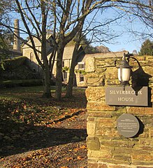
English: Silverbrook House
Another view of SX3869 : Buildings at Wheal St Vincent, showing a plaque describing the listed status of the site. |
| Date | |
| Source | https://www.geograph.org.uk/photo/4237341 |
| Author | Derek Harper |
| Attribution (required by the license) | Derek Harper / Silverbrook House / |
| Camera location | | View this and other nearby images on: OpenStreetMap |
|---|
.jpg¶ms=050.503840_N_-004.278100_E_globe:Earth_type:camera_source:geograph-osgb36(SX38546959)_region:GB-GBN_heading:315.00&language=en)
| Object location | | View this and other nearby images on: OpenStreetMap |
|---|
.jpg¶ms=050.503930_N_-004.278100_E_globe:Earth_class:object_type:object_source:geograph-osgb36(SX38546960)_region:GB-GBN_heading:315.00&language=en)
Licensing[edit]
.jpg&action=edit§ion=2)

|
This image was taken from the Geograph project collection. See this photograph's page on the Geograph website for the photographer's contact details. The copyright on this image is owned by Derek Harper and is licensed for reuse under the Creative Commons Attribution-ShareAlike 2.0 license.
|
This file is licensed under the Creative Commons Attribution-Share Alike 2.0 Generic license.
Attribution: Derek Harper
- You are free:
- to share – to copy, distribute and transmit the work
- to remix – to adapt the work
- Under the following conditions:
- attribution – You must give appropriate credit, provide a link to the license, and indicate if changes were made. You may do so in any reasonable manner, but not in any way that suggests the licensor endorses you or your use.
- share alike – If you remix, transform, or build upon the material, you must distribute your contributions under the same or compatible license as the original.
This file, which was originally posted to
https://www.geograph.org.uk/photo/4237341, was reviewed on 19 October 2018 by reviewer Leoboudv, who confirmed that it was available there under the stated license on that date.
|
File history
Click on a date/time to view the file as it appeared at that time.
| Date/Time | Thumbnail | Dimensions | User | Comment | |
|---|---|---|---|---|---|
| current | 19:19, 17 October 2018 | | 2,549 × 2,795 (989 KB) | Ourmark (talk | contribs) | User created page with UploadWizard |
You cannot overwrite this file.
File usage on Commons
The following page uses this file:
- File:Geograph-4237341-by-Derek-Harper.jpg (file redirect)
.jpg&oldid=546202895)