File:Sheffield Area 1950.png
Jump to navigation
Jump to search
Size of this preview: 707 × 600 pixels. Other resolutions: 283 × 240 pixels | 566 × 480 pixels | 905 × 768 pixels | 1,207 × 1,024 pixels | 1,463 × 1,241 pixels.
Original file (1,463 × 1,241 pixels, file size: 46 KB, MIME type: image/png)
Captions
Captions
Add a one-line explanation of what this file represents
Summary[edit]
| Description |
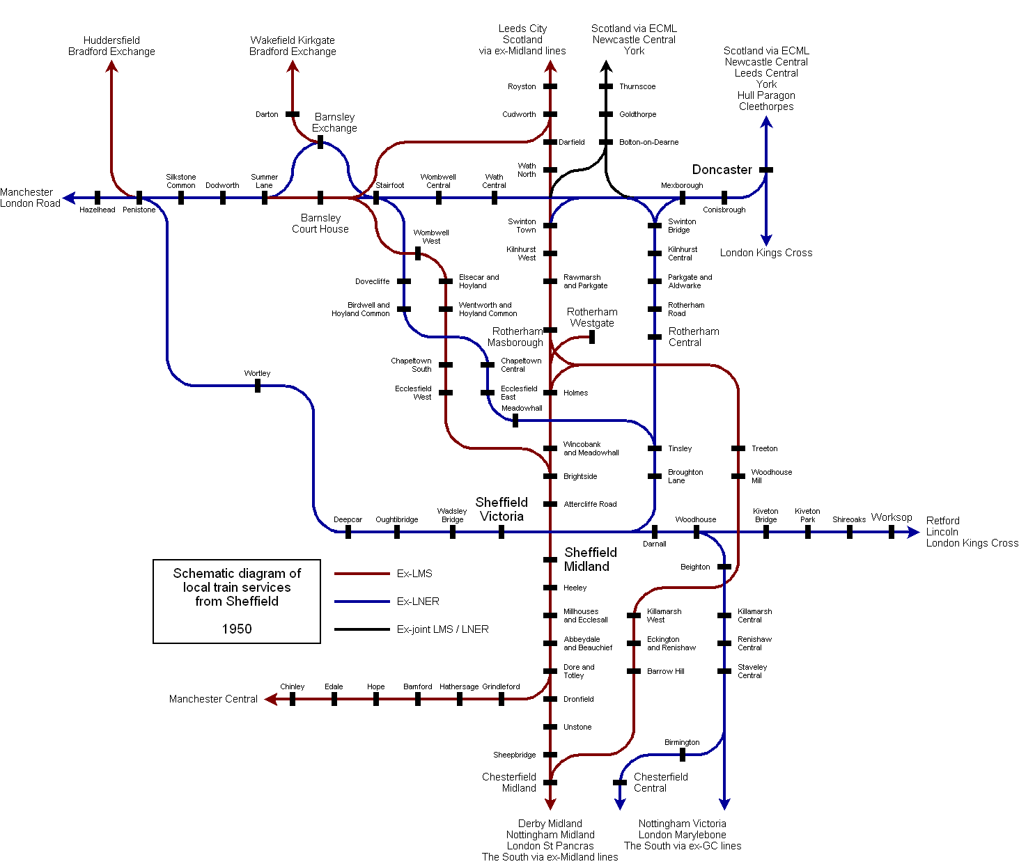
English: Schematic diagram of local rail services from Sheffield in 1950. Showing stations in South Yorkshire, North Derbyshire and North Nottinghamshire. Doncaster-Barnsley and Barnsley-Cudworth lines shown for completeness. Compare with File:Sheffield Area 2000.png. |
| Date | |
| Source | File:Sheffield Area 1950.svg |
| Author | BaseTurnComplete at English Wikipedia |
| Other versions |
File:Sheffield_Area_1950.svg (source) File:Sheffield_Area_1950_(rev).svg (revised) File:Sheffield_Area_1950_antialias.png (rendered from SVG with smooth fonts but not fully accurate) |
.svg)
Licensing[edit]
| I, the copyright holder of this work, release this work into the public domain. This applies worldwide. In some countries this may not be legally possible; if so: I grant anyone the right to use this work for any purpose, without any conditions, unless such conditions are required by law. |
Original upload log[edit]
The original description page was here. All following user names refer to en.wikipedia.
| Upload date | User | Bytes | Dimensions | Comment |
|---|---|---|---|---|
| 2007-01-07 09:32:57 | BaseTurnComplete | 47167 | 1463×1241 | ==Summary== Schematic diagram of local rail services from Sheffield in 1950. Showing stations in South Yorkshire, North Derbyshire and North Nottinghamshire. Doncaster - Barnsley and Barnsley - Cudworth lines shown for completeness. Compare with [[Imag |
| 2007-01-06 21:33:00 | BaseTurnComplete | 46040 | 1403×1208 |
File history
Click on a date/time to view the file as it appeared at that time.
| Date/Time | Thumbnail | Dimensions | User | Comment | |
|---|---|---|---|---|---|
| current | 09:16, 28 November 2009 | | 1,463 × 1,241 (46 KB) | CommonsHelper2 Bot (talk | contribs) | {{BotMoveToCommons|en.wikipedia|year={{subst:CURRENTYEAR}}|month={{subst:CURRENTMONTHNAME}}|day={{subst:CURRENTDAY}}}} Schematic diagram of local rail services from Sheffield in 1950. Showing stations in South Yorkshire, North Derbyshire and North Notti |
You cannot overwrite this file.
File usage on Commons
The following page uses this file: