File:SeychellesBIOT1970.jpg
Jump to navigation
Jump to search
No higher resolution available.
SeychellesBIOT1970.jpg (780 × 283 pixels, file size: 72 KB, MIME type: image/jpeg)
Captions
Captions
Add a one-line explanation of what this file represents
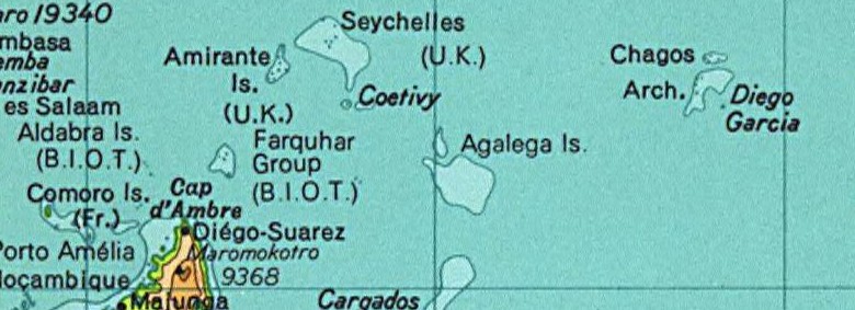
Map of the Seychelles and British Indian Ocean Territory prior to 1976. From the National Atlas as mirrored by the PCL.
This map was obtained from an edition of the National Atlas of the United States. Like almost all works of the U.S. federal government, works from the National Atlas are in the public domain in the United States.
Online access: NationalAtlas.gov | 1970 print edition: Library of Congress, Perry-Castañeda Library
|
This map was cropped from there.
File history
Click on a date/time to view the file as it appeared at that time.
| Date/Time | Thumbnail | Dimensions | User | Comment | |
|---|---|---|---|---|---|
| current | 02:01, 13 August 2005 | 780 × 283 (72 KB) | Hoshie (talk | contribs) | Map of the Seychelles and British Indian Ocean Territory piror to 1976. From the National Atlas as mirrored by the [http://www.lib.utexas.edu/maps/ PCL]. {{PD-USGov-Atlas}} {{PD-PCL|http://www.lib.utexas.edu/maps/national_atlas_1970/ca000244_large.jpg}} |
You cannot overwrite this file.
File usage on Commons
The following page uses this file:
File usage on other wikis
The following other wikis use this file:
- Usage on af.wikipedia.org
- Usage on ast.wikipedia.org
- Usage on ca.wikipedia.org
- Usage on el.wikipedia.org
- Usage on en.wikipedia.org
- Usage on eo.wikipedia.org
- Usage on id.wikipedia.org
- Usage on tl.wikipedia.org
- Usage on zh.wikipedia.org