File:Sediment in the Gulf of Mexico.jpg
Jump to navigation
Jump to search
Size of this preview: 657 × 599 pixels. Other resolutions: 263 × 240 pixels | 526 × 480 pixels | 842 × 768 pixels | 1,123 × 1,024 pixels | 2,246 × 2,048 pixels | 4,804 × 4,381 pixels.
Original file (4,804 × 4,381 pixels, file size: 6.11 MB, MIME type: image/jpeg)
Captions
Captions
Add a one-line explanation of what this file represents
Summary[edit]
| Description |
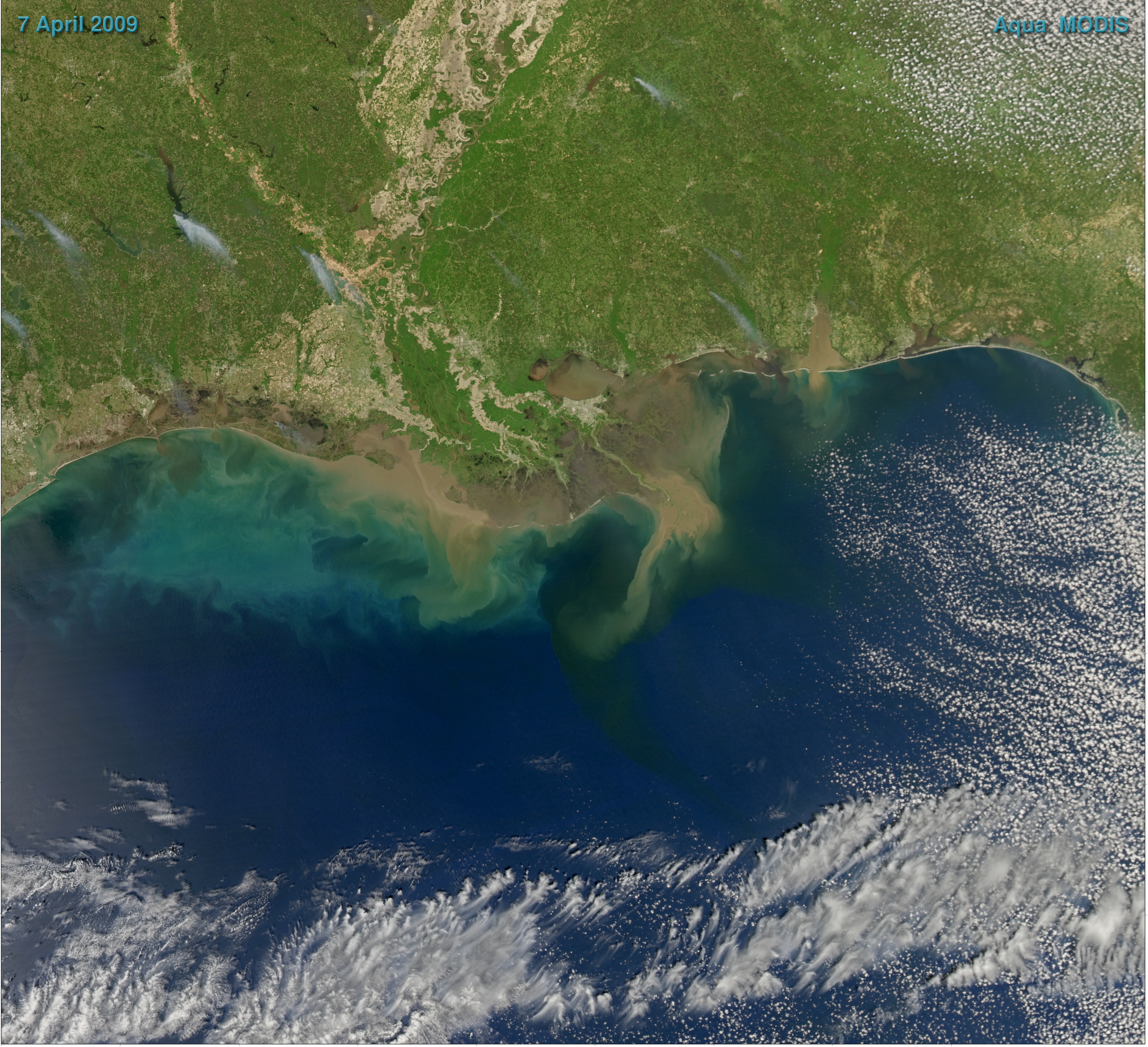
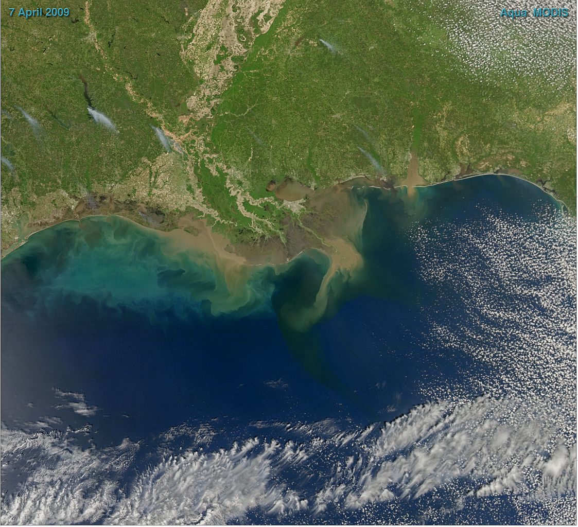
English: Sediment-laden water pours into the northern Gulf of Mexico from the Atchafalaya River in this photo-like image, taken by the Moderate Resolution Imaging Spectroradiometer (MODIS) on NASA’s Aqua satellite. The springtime river plume is distinct in the sediment-laden coastal water, turning the water the color of land. The tan gradually fades to clouds of green and blue as the sediment disperses. |
| Date | |
| Source | NASA Earth Observatory |
| Author | Norman Kuring |
| Other versions |
|
.jpg)
NASA image courtesy Norman Kuring, Ocean Color Team.
Licensing[edit]
| This file is in the public domain in the United States because it was solely created by NASA. NASA copyright policy states that "NASA material is not protected by copyright unless noted". (See Template:PD-USGov, NASA copyright policy page or JPL Image Use Policy.) | ||
 |
Warnings:
|
File history
Click on a date/time to view the file as it appeared at that time.
| Date/Time | Thumbnail | Dimensions | User | Comment | |
|---|---|---|---|---|---|
| current | 08:55, 29 September 2009 | | 4,804 × 4,381 (6.11 MB) | Cropbot (talk | contribs) | upload cropped version, operated by User:Originalwana. Summary: cropped |
| 16:10, 19 April 2009 |  | 5,087 × 4,672 (6.32 MB) | Originalwana (talk | contribs) | {{Information |Description={{en|1=Sediment-laden water pours into the northern Gulf of Mexico from the Atchafalaya River in this photo-like image, taken by the Moderate Resolution Imaging Spectroradiometer (MODIS) on NASA’s Aqua satellite. The springtim |
You cannot overwrite this file.
File usage on Commons
The following 2 pages use this file:
File usage on other wikis
The following other wikis use this file:
- Usage on ar.wikipedia.org
- Usage on ckb.wikipedia.org
- Usage on en.wikipedia.org
- Usage on fr.wikipedia.org
- Usage on hi.wikipedia.org
- Usage on hy.wikipedia.org
- Usage on incubator.wikimedia.org
- Usage on sr.wikipedia.org
- Usage on tl.wikipedia.org
- Usage on uk.wikipedia.org
- Usage on vi.wikipedia.org