File:Secunda Europae tabula (7537877568).jpg
Jump to navigation
Jump to search

Size of this preview: 786 × 600 pixels. Other resolutions: 315 × 240 pixels | 629 × 480 pixels | 1,007 × 768 pixels | 1,280 × 977 pixels | 2,000 × 1,526 pixels.
Original file (2,000 × 1,526 pixels, file size: 3.15 MB, MIME type: image/jpeg)
Captions
Captions
Add a one-line explanation of what this file represents
Summary[edit]
| Description |
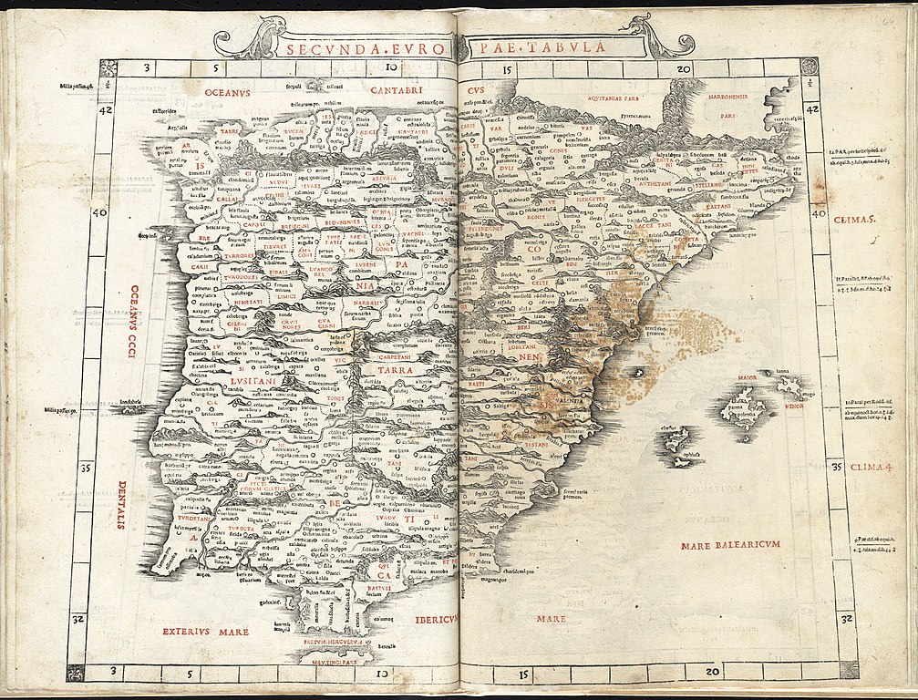
English: Ptolemy's 2nd European Map (Secunda Europae Tabula), depicting Roman Spain (Hispania) and Portugal (Lusitania)
Zoom into this map at maps.bpl.org. Author: Ptolemy, 2nd cent. Publisher: Pencio, Jacopo Date: 1511 Location: Iberian Peninsula, Portugal, Spain Dimension: 39 x 50 cm. Scale: [ca. 1:3,500,000] Call Number: G1005 .P7 1511Latina: In secunda Tabula Ispaniarum scilicet Bectica nunc Granatae Lusitania/portugalia Tarraconensis |
| Date | |
| Source |
|
| Author | http://maps.bpl.org |
| Other versions |
|
.jpg)
,_por_Bernardus_Sylvanus.jpg)

.jpg&action=edit§ion=1)
Licensing[edit]
.jpg&action=edit§ion=2)
This file is licensed under the Creative Commons Attribution 2.0 Generic license.
- You are free:
- to share – to copy, distribute and transmit the work
- to remix – to adapt the work
- Under the following conditions:
- attribution – You must give appropriate credit, provide a link to the license, and indicate if changes were made. You may do so in any reasonable manner, but not in any way that suggests the licensor endorses you or your use.
| This image, originally posted to Flickr, was reviewed on 21 August 2013 by the administrator or reviewer File Upload Bot (Magnus Manske), who confirmed that it was available on Flickr under the stated license on that date. |
File history
Click on a date/time to view the file as it appeared at that time.
| Date/Time | Thumbnail | Dimensions | User | Comment | |
|---|---|---|---|---|---|
| current | 03:59, 21 August 2013 | | 2,000 × 1,526 (3.15 MB) | File Upload Bot (Magnus Manske) (talk | contribs) | Transferred from Flickr by User:tm |
You cannot overwrite this file.
File usage on Commons
The following 4 pages use this file:
.jpg&oldid=810099754)