File:Seçim2015ililçe.png
Jump to navigation
Jump to search
Size of this preview: 679 × 600 pixels. Other resolutions: 272 × 240 pixels | 543 × 480 pixels | 1,012 × 894 pixels.
Original file (1,012 × 894 pixels, file size: 92 KB, MIME type: image/png)
Captions
Captions
Add a one-line explanation of what this file represents
Summary[edit]
| Description |
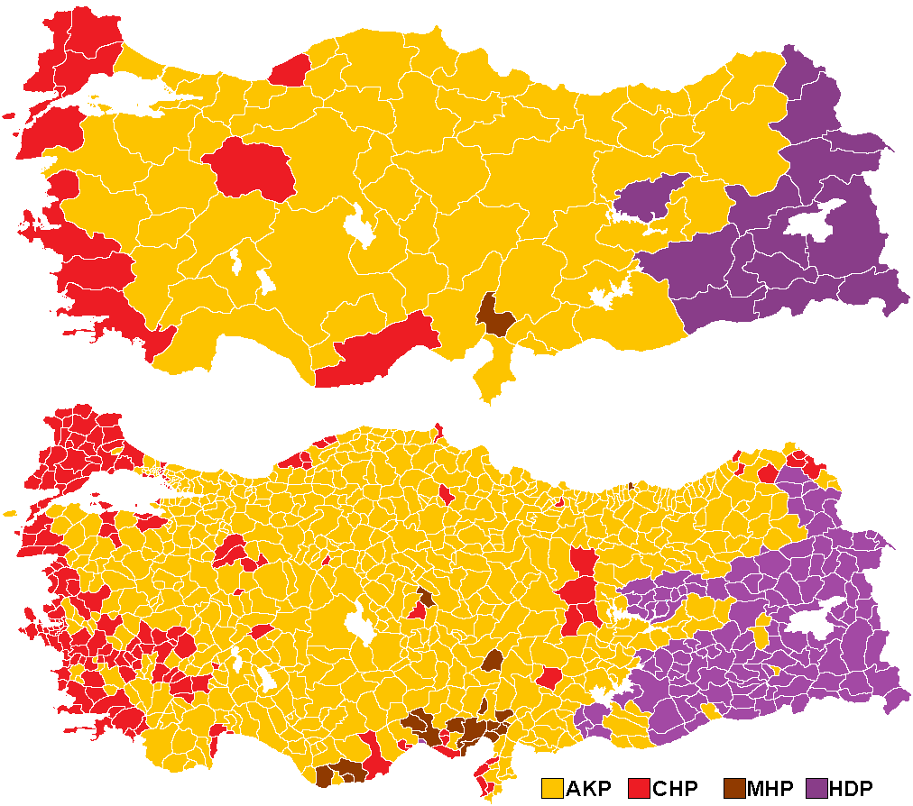
Türkçe: 2015 seçimleri il ve ilçe haritası |
| Date | |
| Source | Own work |
| Author | Emreculha |
Licensing[edit]
I, the copyright holder of this work, hereby publish it under the following license:
This file is licensed under the Creative Commons Attribution-Share Alike 4.0 International license.
- You are free:
- to share – to copy, distribute and transmit the work
- to remix – to adapt the work
- Under the following conditions:
- attribution – You must give appropriate credit, provide a link to the license, and indicate if changes were made. You may do so in any reasonable manner, but not in any way that suggests the licensor endorses you or your use.
- share alike – If you remix, transform, or build upon the material, you must distribute your contributions under the same or compatible license as the original.
File history
Click on a date/time to view the file as it appeared at that time.
| Date/Time | Thumbnail | Dimensions | User | Comment | |
|---|---|---|---|---|---|
| current | 08:09, 10 April 2023 | | 1,012 × 894 (92 KB) | Randam (talk | contribs) | Reverted to version as of 09:05, 28 June 2015 (UTC). Copyvio. The portraits are from government website which are not licensed under CC BY-SA 4.0. |
| 20:02, 3 April 2023 | No thumbnail | 1,894 × 2,450 (673 KB) | Cogitosuzergosum (talk | contribs) | Önceki haritada gözden kaçan yerler düzeltildi | |
| 19:59, 3 April 2023 | No thumbnail | 1,894 × 2,450 (693 KB) | Cogitosuzergosum (talk | contribs) | Haritaya ölçek eklendi. Haritanın uluslararası okunabilirliğinin artması için İngilizce başlıklar eklendi. Genel başkanların fotoğrafları eklendi | |
| 17:10, 16 August 2022 |  | 1,992 × 1,978 (265 KB) | Cogitosuzergosum (talk | contribs) | Ankara'daki bölge numaralandırılması, Çanakkale'de adaların renkleri düzeltildi | |
| 11:53, 16 August 2022 |  | 1,992 × 1,978 (281 KB) | Cogitosuzergosum (talk | contribs) | Haritadaki ilçe sınırları düzeltildi ve eksik ilçeler eklendi | |
| 09:05, 28 June 2015 |  | 1,012 × 894 (92 KB) | Epann (talk | contribs) | Yanlış renklendirilen Tekirdağ/Muratlı düzeltildi. | |
| 16:48, 22 June 2015 |  | 1,012 × 894 (62 KB) | Emreculha (talk | contribs) | güncelleme | |
| 16:41, 22 June 2015 |  | 1,012 × 894 (61 KB) | Emreculha (talk | contribs) | User created page with UploadWizard |
You cannot overwrite this file.
File usage on Commons
The following 2 pages use this file:
File usage on other wikis
The following other wikis use this file:
- Usage on it.wikipedia.org
- Usage on ku.wikipedia.org
- Usage on nl.wikipedia.org