File:Schröfeln-KartenausschnittBlatt8434.JPG
Jump to navigation
Jump to search

Size of this preview: 800 × 600 pixels. Other resolutions: 320 × 240 pixels | 640 × 480 pixels | 1,024 × 768 pixels | 1,280 × 960 pixels | 2,560 × 1,920 pixels | 3,264 × 2,448 pixels.
Original file (3,264 × 2,448 pixels, file size: 3.92 MB, MIME type: image/jpeg)
Captions
Captions
Add a one-line explanation of what this file represents
Summary
[edit]
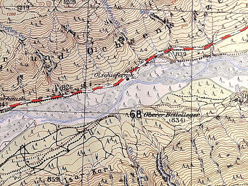
| Description | Ölschieferwerk Schröfeln im Oberen Isartal |
| Date | |
| Source | Landesvermessungsamt Bayern, Blatt 8434 von 1956 |
| Author | Jost Gudelius |
| Camera location | | View this and other nearby images on: OpenStreetMap |
|---|
Licensing
[edit]
| This image is in the public domain according to German copyright law because it is part of a statute, ordinance, official decree or judgment (official work) issued by a German authority or court (§ 5 Abs.1 UrhG).
|
 |
File history
Click on a date/time to view the file as it appeared at that time.
| Date/Time | Thumbnail | Dimensions | User | Comment | |
|---|---|---|---|---|---|
| current | 16:16, 30 November 2016 | | 3,264 × 2,448 (3.92 MB) | JostGudelius (talk | contribs) | {{Information |Description=Ölschieferwerk Schröfeln im Oberen Isartal |Source=Landesvermessungsamt Bayern, Blatt 8434 von 1956 |Date=1956 |Author=Jost Gudelius |Permission= |other_versions= }} |
You cannot overwrite this file.
File usage on Commons
There are no pages that use this file.
File usage on other wikis
The following other wikis use this file:
- Usage on de.wikipedia.org