File:Scandinavia1219.png
Jump to navigation
Jump to search
Size of this preview: 513 × 600 pixels. Other resolutions: 205 × 240 pixels | 410 × 480 pixels | 657 × 768 pixels | 876 × 1,024 pixels | 1,500 × 1,754 pixels.
Original file (1,500 × 1,754 pixels, file size: 41 KB, MIME type: image/png)
Captions
Captions
Add a one-line explanation of what this file represents
| Description |
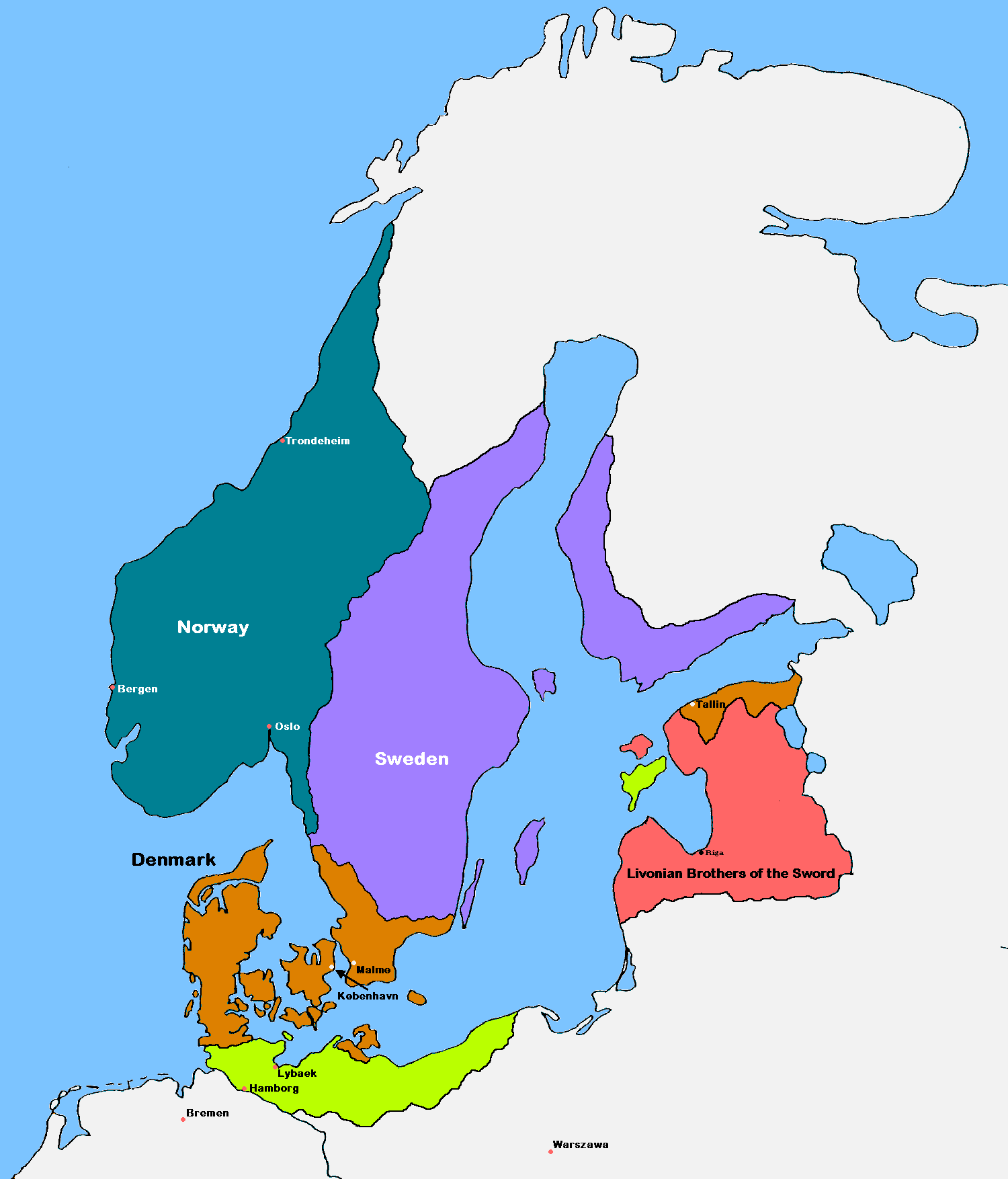
English: Update of the historical and political map, created in 2005 by Kasper Holl. It is a compressed format, has an easier colour scheme and has greater sized labels. NB on accuracy: Sweden did not reach this size until after the 1330s, when colonialization of Västerbotten started. Swedish colonialization of Finnish coast started before 1250. Sweden lost Gotland to Denmark in 1361. Trondheim has a wrong placement on map.
Denmark
Norway
Sweden
The Sword Brethren
Territories conquered by Denmark in 1219 |
| Date | (UTC) |
| Source |
|
| Author | MasterOfHisOwnDomain |
| Other versions |
|

I, the copyright holder of this work, hereby publish it under the following licenses:

|
Permission is granted to copy, distribute and/or modify this document under the terms of the GNU Free Documentation License, Version 1.2 or any later version published by the Free Software Foundation; with no Invariant Sections, no Front-Cover Texts, and no Back-Cover Texts. A copy of the license is included in the section entitled GNU Free Documentation License. |
| This file is licensed under the Creative Commons Attribution-Share Alike 3.0 Unported license. | ||
| ||
| This licensing tag was added to this file as part of the GFDL licensing update. |
You may select the license of your choice.
File history
Click on a date/time to view the file as it appeared at that time.
| Date/Time | Thumbnail | Dimensions | User | Comment | |
|---|---|---|---|---|---|
| current | 17:18, 16 September 2016 | | 1,500 × 1,754 (41 KB) | VulpesVulpes42 (talk | contribs) | According to the description, the cities of Stockholm and Göteborg did not exist in 1219, so I removed them from the map. |
| 14:37, 12 August 2009 |  | 1,500 × 1,754 (68 KB) | MasterOfHisOwnDomain (talk | contribs) | Update of the historical and political map, created in 2005 by Kasper Holl. It is a compressed format, has an easier colour scheme and has greater sized labels. {{Self|GFDL|Cc-by-sa-3.0-migrated}} Category:Maps of the history of Denmark [[Category: |
You cannot overwrite this file.
File usage on Commons
The following 2 pages use this file:
File usage on other wikis
The following other wikis use this file:
- Usage on ast.wikipedia.org
- Usage on be.wikipedia.org
- Usage on ca.wikipedia.org
- Usage on cs.wikipedia.org
- Usage on da.wikipedia.org
- Usage on de.wikipedia.org
- Usage on dsb.wikipedia.org
- Usage on el.wikipedia.org
- Usage on en.wikipedia.org
- Usage on eo.wikipedia.org
- Usage on es.wikipedia.org
- Usage on et.wikipedia.org
- Usage on fr.wikipedia.org
- Usage on fy.wikipedia.org
- Usage on id.wikipedia.org
View more global usage of this file.