File:Saxton Brecknock Cardigan Carmarthen Radnor.jpg
Jump to navigation
Jump to search

Size of this preview: 762 × 599 pixels. Other resolutions: 305 × 240 pixels | 610 × 480 pixels | 769 × 605 pixels.
Original file (769 × 605 pixels, file size: 174 KB, MIME type: image/jpeg)
Captions
Captions
Add a one-line explanation of what this file represents
Summary
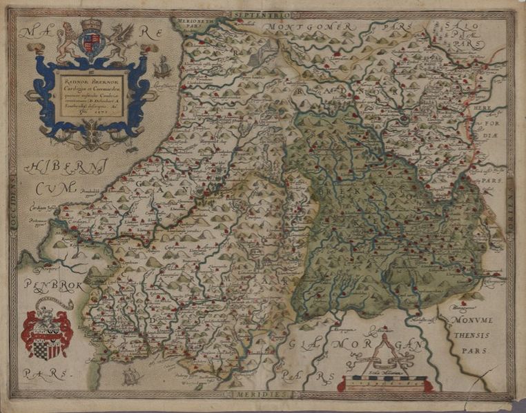
[edit]| Brecknock, Cardigan, Carmarthen and Radnor
( |
||||||||||||||||||||||||
|---|---|---|---|---|---|---|---|---|---|---|---|---|---|---|---|---|---|---|---|---|---|---|---|---|
| Artist |
Saxton, Christopher b.1542? |
|||||||||||||||||||||||
| Title |
Brecknock, Cardigan, Carmarthen and Radnor |
|||||||||||||||||||||||
| Description |
Saxton's Welsh County maps were first published in William Camden's 'Britannia', 1607. This was the final Latin version, and the first to be illustrated with maps. |
|||||||||||||||||||||||
| Date | 1607 | |||||||||||||||||||||||
| Dimensions | height: 190 mm (7.48 in); width: 260 mm (10.23 in) | |||||||||||||||||||||||
| Collection |
|
|||||||||||||||||||||||
| Notes | Scale [ca.1:196,000]. 3.3 inches = 10 miles. | |||||||||||||||||||||||
| Source/Photographer |
|
|||||||||||||||||||||||
| Permission (Reusing this file) |
|
|||||||||||||||||||||||


File history
Click on a date/time to view the file as it appeared at that time.
| Date/Time | Thumbnail | Dimensions | User | Comment | |
|---|---|---|---|---|---|
| current | 13:01, 21 October 2015 | | 769 × 605 (174 KB) | Jason.nlw (talk | contribs) | User created page with UploadWizard |
You cannot overwrite this file.
File usage on Commons
The following 3 pages use this file:
File usage on other wikis
The following other wikis use this file:
- Usage on cy.wikipedia.org
- Usage on es.wikipedia.org
- Usage on ku.wikipedia.org
- Usage on ru.wikipedia.org
- Usage on www.wikidata.org