File:Satellite picture of the Nile Delta, Egypt.jpg
Jump to navigation
Jump to search

Size of this preview: 800 × 600 pixels. Other resolutions: 320 × 240 pixels | 640 × 480 pixels | 1,000 × 750 pixels.
Original file (1,000 × 750 pixels, file size: 141 KB, MIME type: image/jpeg)
Captions
Captions
Add a one-line explanation of what this file represents
Summary[edit]
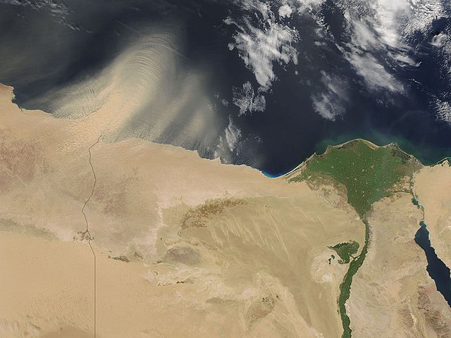
| Description | Original caption — Ripples on the wind create intricate wave patterns in a thick plume of dust over Egypt (right) and Libya (left), in this image from the Moderate Resolution Imaging Spectroradiometer (MODIS) on NASA’s Aqua satellite. |
| Date | 13 July 2006 |
| Source | NASA (Image galleries) |
| Author | National Aeronautics and Space Administration (NASA) |
Licensing[edit]
| This file is in the public domain in the United States because it was solely created by NASA. NASA copyright policy states that "NASA material is not protected by copyright unless noted". (See Template:PD-USGov, NASA copyright policy page or JPL Image Use Policy.) | ||
 |
Warnings:
|
File history
Click on a date/time to view the file as it appeared at that time.
| Date/Time | Thumbnail | Dimensions | User | Comment | |
|---|---|---|---|---|---|
| current | 20:10, 14 July 2006 | | 1,000 × 750 (141 KB) | Felipe Menegaz (talk | contribs) | {{Information| |Description= Ripples on the wind create intricate wave patterns in a thick plume of dust over Egypt (right) and Libya (left), in this image from the Moderate Resolution Imaging Spectroradiometer (MODIS) on NASA’s Aqua satellite. Image |
You cannot overwrite this file.
File usage on Commons
The following 2 pages use this file:
File usage on other wikis
The following other wikis use this file:
- Usage on azb.wikipedia.org
- Usage on ca.wikipedia.org
- Usage on ka.wikipedia.org
- Usage on ko.wikipedia.org
- Usage on pt.wikipedia.org
- Usage on ro.wikipedia.org