File:Satellite image of Bir Tawil.jpg
Jump to navigation
Jump to search

Size of this preview: 800 × 396 pixels. Other resolutions: 320 × 158 pixels | 640 × 317 pixels | 1,024 × 507 pixels | 1,280 × 634 pixels | 4,031 × 1,996 pixels.
Original file (4,031 × 1,996 pixels, file size: 1.23 MB, MIME type: image/jpeg)
Captions
Captions
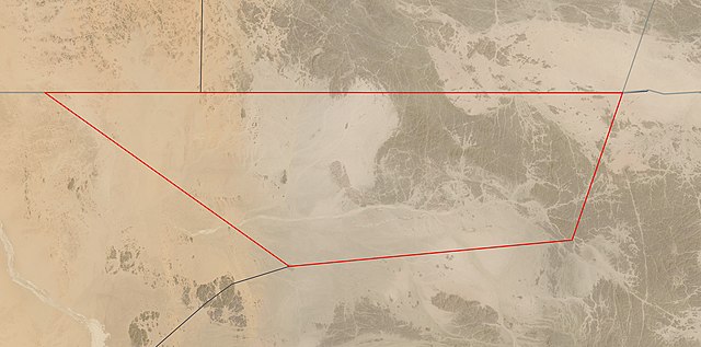
Satellite image of Bir Tawil
Summary
[edit]
Licensing
[edit]
| This file is in the public domain in the United States because it was solely created by NASA. NASA copyright policy states that "NASA material is not protected by copyright unless noted". (See Template:PD-USGov, NASA copyright policy page or JPL Image Use Policy.) | ||
 |
Warnings:
|
File history
Click on a date/time to view the file as it appeared at that time.
| Date/Time | Thumbnail | Dimensions | User | Comment | |
|---|---|---|---|---|---|
| current | 03:02, 19 May 2021 | | 4,031 × 1,996 (1.23 MB) | Themium (talk | contribs) | New border map from https://worldview.earthdata.nasa.gov/ (2nd try) |
| 19:56, 18 May 2021 |  | 4,031 × 1,996 (1.23 MB) | Themium (talk | contribs) | New border map from https://worldview.earthdata.nasa.gov/ | |
| 23:17, 12 April 2021 |  | 4,167 × 2,008 (1.26 MB) | Themium (talk | contribs) | Uploaded a work by Landsat 8 / OLI from https://worldview.earthdata.nasa.gov/?v=32.55626092826267,21.355252631649694,34.600300491074385,22.35704493821523&l=Reference_Labels(hidden),Reference_Features(hidden),Coastlines(hidden),HLS_L30_Nadir_BRDF_Adjusted_Reflectance,MODIS_Combined_L3_Nadir-BRDF_Daily(hidden),VIIRS_NOAA20_CorrectedReflectance_TrueColor(hidden),VIIRS_SNPP_CorrectedReflectance_TrueColor(hidden),MODIS_Aqua_CorrectedReflectance_TrueColor(hidden),MODIS_Terra_CorrectedReflectance_Tr... |
You cannot overwrite this file.
File usage on Commons
The following page uses this file:
File usage on other wikis
The following other wikis use this file:
- Usage on ar.wikipedia.org
- Usage on arz.wikipedia.org
- Usage on ast.wikipedia.org
- Usage on be.wikipedia.org
- Usage on ca.wikipedia.org
- Usage on de.wikivoyage.org
- Usage on en.wikipedia.org
- Usage on en.wikivoyage.org
- Usage on eo.wikipedia.org
- Usage on es.wikipedia.org
- Usage on gl.wikipedia.org
- Usage on he.wikipedia.org
- Usage on ja.wikipedia.org
- Usage on pt.wikipedia.org
- Usage on ro.wikipedia.org
- Usage on tr.wikipedia.org
- Usage on www.wikidata.org