File:SasBecè.jpg
Jump to navigation
Jump to search
Size of this preview: 800 × 449 pixels. Other resolutions: 320 × 180 pixels | 640 × 360 pixels | 1,024 × 575 pixels | 1,280 × 719 pixels | 2,592 × 1,456 pixels.
Original file (2,592 × 1,456 pixels, file size: 1.61 MB, MIME type: image/jpeg)
Captions
Captions
Add a one-line explanation of what this file represents
Summary[edit]
![]() Italy
Italy ![]() Trentino-Alto Adige/Südtirol
Trentino-Alto Adige/Südtirol ![]() Province Trient (Grenze:
Province Trient (Grenze: ![]() Veneto
Veneto ![]() Province of Belluno
>
Province of Belluno
> ![]() Provinz Bozen) - Dolomiten 2.353 m s.l.m.
Provinz Bozen) - Dolomiten 2.353 m s.l.m.
| Description |
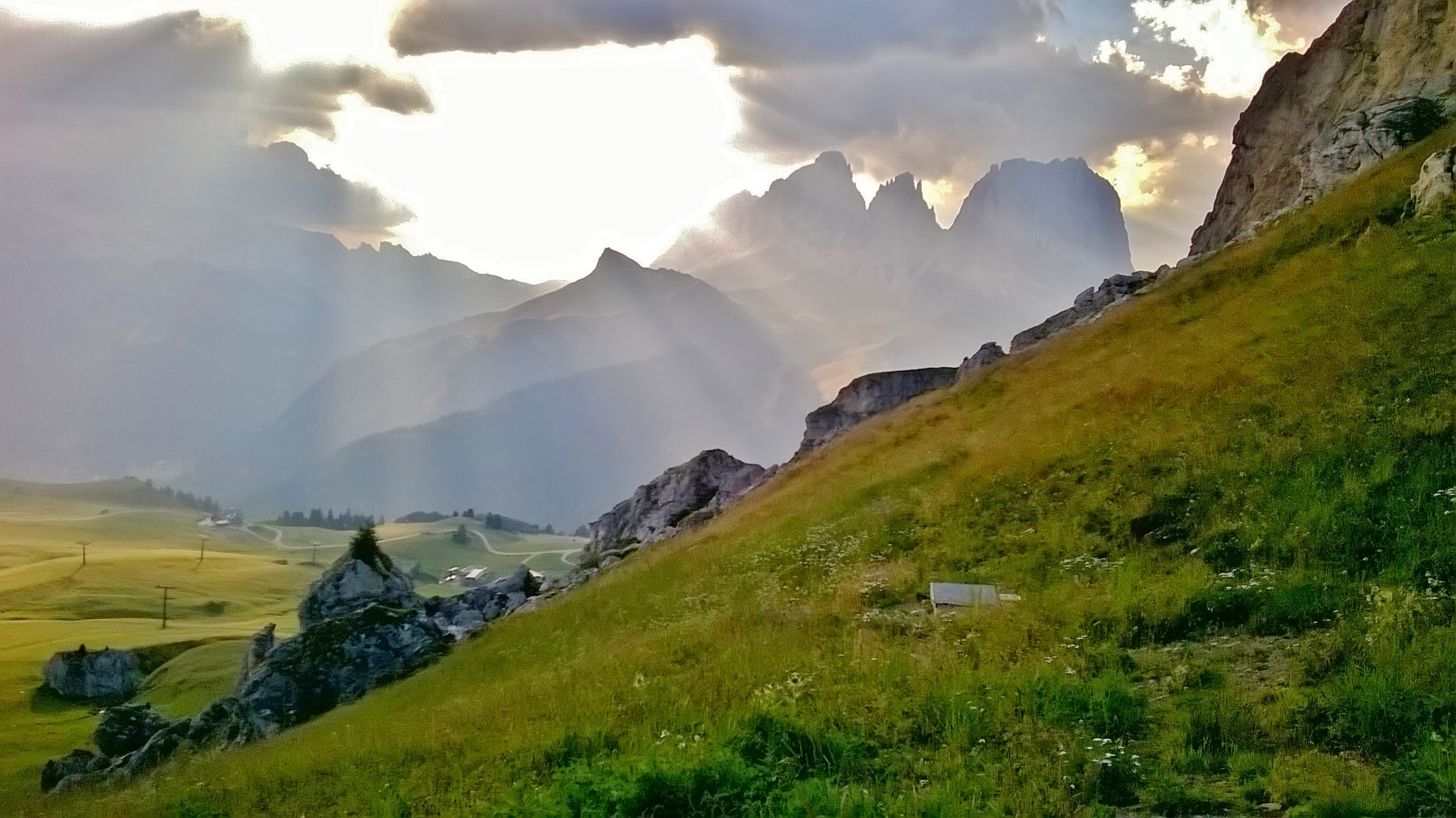
Deutsch: Vom Südrand des Sasso Beccè blicken wir am Abend zum Col Rodella und zur Langkofelgruppe. |
| Date | Taken on 10 August 2015, 18:58:24 |
| Source | Own work |
| Author | FkMohr, Fotografin Supakon Mohr |
| Camera location | | View this and other nearby images on: OpenStreetMap |
|---|
TN/BL {XH150810-1858} übertragen von Panoramio (User tuimo, Bild 122874020).
Licensing[edit]
Supakon Mohr, the copyright holder of this work, hereby publishes it under the following license:
This file is licensed under the Creative Commons Attribution-Share Alike 3.0 Germany license.
Attribution: Supakon Mohr
- You are free:
- to share – to copy, distribute and transmit the work
- to remix – to adapt the work
- Under the following conditions:
- attribution – You must give appropriate credit, provide a link to the license, and indicate if changes were made. You may do so in any reasonable manner, but not in any way that suggests the licensor endorses you or your use.
- share alike – If you remix, transform, or build upon the material, you must distribute your contributions under the same or compatible license as the original.

File history
Click on a date/time to view the file as it appeared at that time.
| Date/Time | Thumbnail | Dimensions | User | Comment | |
|---|---|---|---|---|---|
| current | 12:45, 3 November 2020 | | 2,592 × 1,456 (1.61 MB) | FkMohr (talk | contribs) | Brighter version. |
| 10:12, 25 September 2017 |  | 2,592 × 1,456 (911 KB) | FkMohr (talk | contribs) | Transferred from http://static.panoramio.com/photos/original/122874020.jpg |
You cannot overwrite this file.
File usage on Commons
The following page uses this file:
File usage on other wikis
The following other wikis use this file:
- Usage on cs.wikipedia.org