File:Sappl 03 2012.JPG
Jump to navigation
Jump to search

Size of this preview: 795 × 600 pixels. Other resolutions: 318 × 240 pixels | 637 × 480 pixels | 1,018 × 768 pixels | 1,280 × 965 pixels | 2,560 × 1,931 pixels | 4,379 × 3,303 pixels.
Original file (4,379 × 3,303 pixels, file size: 11.53 MB, MIME type: image/jpeg)
Captions
Captions
Add a one-line explanation of what this file represents
Summary
[edit]
| Description |
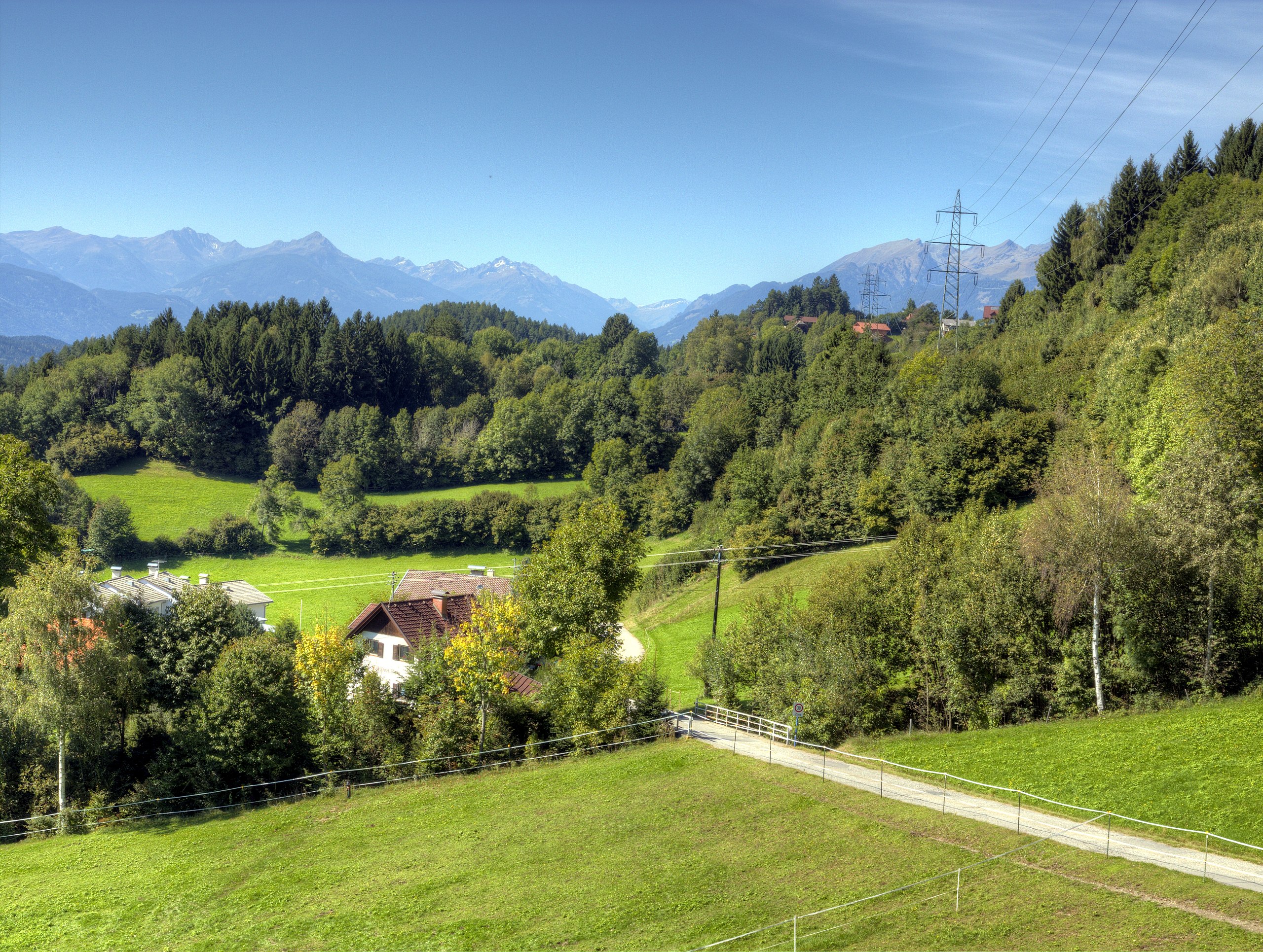
Deutsch: Sappl, eine Ortschaft in der Gemeinde Millstatt, auf einer Seehöhe von ca. 820 m, gelegen am Millstätter Berg (Hochplateau) über dem Millstättersee in Kärnten / Österreich / Europäische Union. Ansicht gegen Westen. Der bewaldete Hügel links im Bild ist der "Sauterbichl". Hinten die Häuser von Görtschach (vulgo Pichler). An dieser Stelle zeigt sich die veränderte Kulturlandschaft in den letzen 60 Jahren sehr gut. Links vorne Häuser und Wohnblocks, die auf früherem landwirtschaftlichen Grund gebaut wurden. Anfang der 1950er Jahre war der "Sauterbichl" noch weitgehend ohne Bewuchs. Die Sicht zum vulgo Keuschpeter bzw. nach Görtschach war nur von wenigen Bäumen am Wiesenrand beeinträchtigt. Einstweilen ist alles zugewachsen. Im Hintergrund de:Kreuzeckgruppe und das Gemeineck, Teil der Reißeckgruppe. English: Sappl near Lake Millstatt (Millstätter See), district Spittal an der Drau in Carinthia / Austria / EU. View to the west. |
|
| Date | ||
| Source | Own work | |
| Author | Joadl | |
| Permission (Reusing this file) |
|
| Camera location | | View this and other nearby images on: OpenStreetMap |
|---|
| Object location | | View this and other nearby images on: OpenStreetMap |
|---|
| This is a retouched picture, which means that it has been digitally altered from its original version. Modifications: HDRI/Tone mapping with Photomatix Pro 4.2.4 of 3 RAW.
|
Licensing
[edit]
I, the copyright holder of this work, hereby publish it under the following licenses:

|
Permission is granted to copy, distribute and/or modify this document under the terms of the GNU Free Documentation License, Version 1.2 or any later version published by the Free Software Foundation; with no Invariant Sections, no Front-Cover Texts, and no Back-Cover Texts. A copy of the license is included in the section entitled GNU Free Documentation License. |
This file is licensed under the Creative Commons Attribution-Share Alike 3.0 Austria license.
- You are free:
- to share – to copy, distribute and transmit the work
- to remix – to adapt the work
- Under the following conditions:
- attribution – You must give appropriate credit, provide a link to the license, and indicate if changes were made. You may do so in any reasonable manner, but not in any way that suggests the licensor endorses you or your use.
- share alike – If you remix, transform, or build upon the material, you must distribute your contributions under the same or compatible license as the original.

You may select the license of your choice.
File history
Click on a date/time to view the file as it appeared at that time.
| Date/Time | Thumbnail | Dimensions | User | Comment | |
|---|---|---|---|---|---|
| current | 20:51, 22 October 2012 | | 4,379 × 3,303 (11.53 MB) | Joadl (talk | contribs) | == {{int:filedesc}} == {{Information |Description = {{Multilingual description |de=Sappl, eine Ortschaft in der Gemeinde Millstatt, auf einer Seehöhe von ca. 820 m, gelegen am [[:de:Millstätter Berg|Millstätter Berg]... |
You cannot overwrite this file.
File usage on Commons
The following page uses this file: