File:Sankt Moritz Lake Piz Muragl.jpg
Jump to navigation
Jump to search
Size of this preview: 800 × 533 pixels. Other resolutions: 320 × 213 pixels | 640 × 427 pixels | 1,024 × 683 pixels | 1,280 × 853 pixels | 2,560 × 1,707 pixels | 5,893 × 3,929 pixels.
Original file (5,893 × 3,929 pixels, file size: 12.57 MB, MIME type: image/jpeg)
Captions
Captions
Add a one-line explanation of what this file represents
Summary[edit]
| Description |
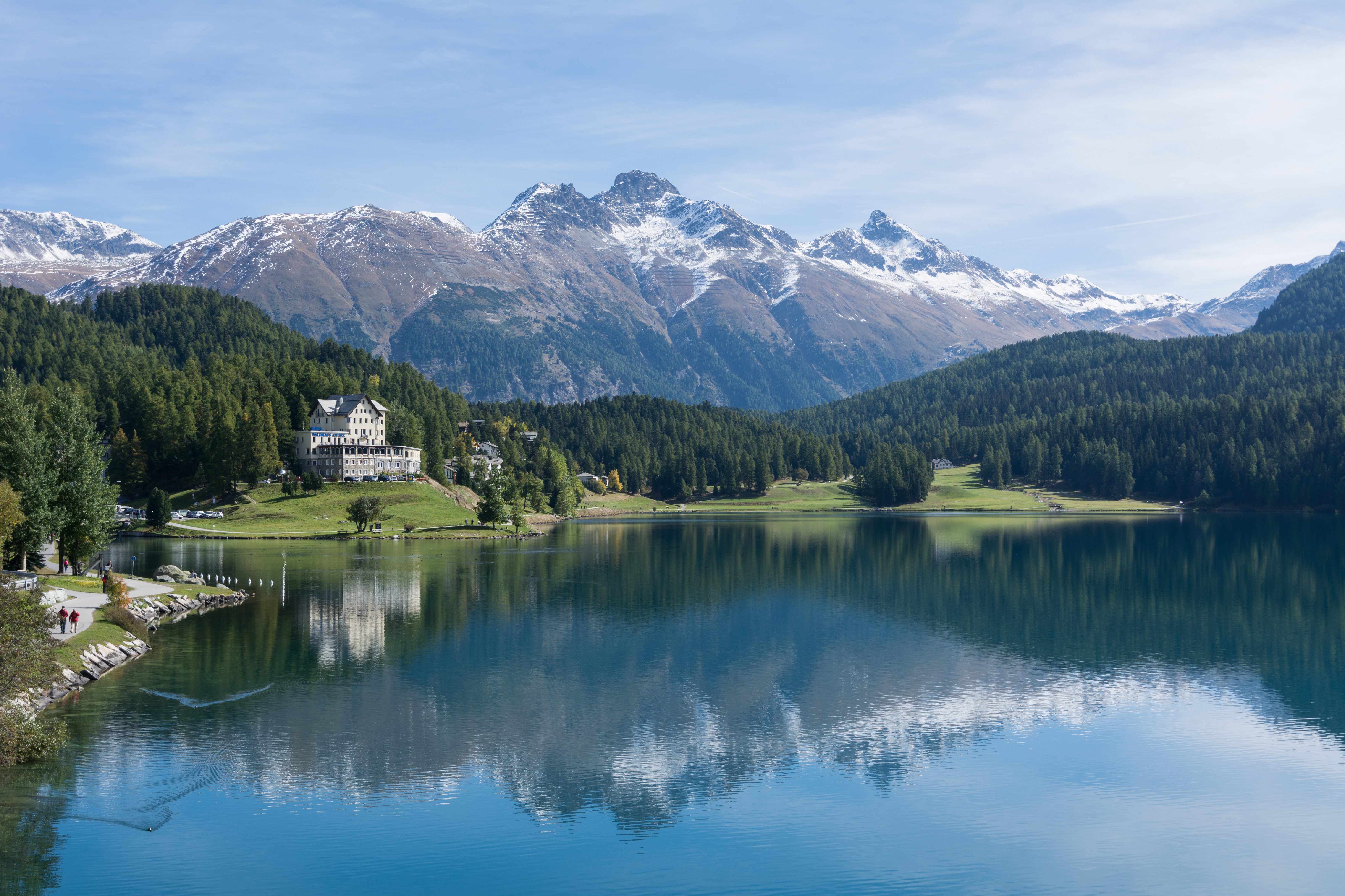
Deutsch: Der St. Moritzersee befindet sich auf einer Höhe von 1768 m und wird vom Inn durchflossen. English: Lake St. Moritz is located at a height of 1768 m in the Upper Engadin, Switzerland. The river Inn flows through this lake. |
| Date | |
| Source | Own work |
| Author | Isiwal |
| Camera location | | View this and other nearby images on: OpenStreetMap |
|---|
Assessment[edit]
|
Licensing[edit]
I, the copyright holder of this work, hereby publish it under the following license:
This file is licensed under the Creative Commons Attribution-Share Alike 4.0 International license.
Attribution: Isiwal/Wikimedia Commons/CC BY-SA 4.0
- You are free:
- to share – to copy, distribute and transmit the work
- to remix – to adapt the work
- Under the following conditions:
- attribution – You must give appropriate credit, provide a link to the license, and indicate if changes were made. You may do so in any reasonable manner, but not in any way that suggests the licensor endorses you or your use.
- share alike – If you remix, transform, or build upon the material, you must distribute your contributions under the same or compatible license as the original.
| Annotations | This image is annotated: View the annotations at Commons |
File history
Click on a date/time to view the file as it appeared at that time.
| Date/Time | Thumbnail | Dimensions | User | Comment | |
|---|---|---|---|---|---|
| current | 15:49, 4 October 2015 | | 5,893 × 3,929 (12.57 MB) | Isiwal (talk | contribs) | VicuñaUploader 1.20 |
You cannot overwrite this file.
File usage on Commons
The following 18 pages use this file:
- User:1992 FARHAAD/Favorites
- User:Cmao20
- User:Isiwal/gallery
- User talk:Cmao20/Archive 2021
- User talk:Isiwal
- Commons:Featured picture candidates/File:Sankt Moritz Lake Piz Muragl.jpg
- Commons:Featured picture candidates/Log/November 2021
- Commons:Featured pictures/Places/Natural/Switzerland
- Commons:Featured pictures/chronological/2021-B
- Commons:Featured pictures/chronological/November 2021
- Commons:Picture of the Year/2021/Candidates
- Commons:Picture of the Year/2021/R1/Gallery/2021-B
- Commons:Picture of the Year/2021/R1/Gallery/ALL
- Commons:Picture of the Year/2021/R1/Gallery/M11
- Commons:Picture of the Year/2021/R1/Gallery/Waters
- Commons:Picture of the Year/2021/R1/v/Sankt Moritz Lake Piz Muragl.jpg
- Commons:Quality images/Subject/Places/Mixed/Archive1
- Commons:Quality images candidates/Archives October 07 2015
File usage on other wikis
The following other wikis use this file:
- Usage on am.wikipedia.org
- Usage on cs.wikipedia.org
- Usage on de.wikipedia.org
- Usage on fa.wikipedia.org
- Usage on fr.wikipedia.org
- Usage on pl.wikipedia.org
Metadata
Categories:
- Snow fences in Switzerland
- Lake St. Moritz
- Piz Muragl
- Piz Languard
- Waldhaus am See (St. Moritz)
- Water reflections of mountains in Switzerland
- Reflections in lakes in Switzerland
- Oberengadin
- Las Sours
- Mountains with snow in Switzerland
- Snow in Europe in September
- Reflections in lakes
- Water reflections of trees in Switzerland
- Water reflections of buildings in Switzerland
- Water reflections of clouds in Switzerland
- Clouds and blue sky in Switzerland
- Forests in the canton of Graubünden
- Landscapes of the canton of Graubünden
- 2015 in the canton of Graubünden