File:Sand Mountain volcanic field.jpg
Jump to navigation
Jump to search
No higher resolution available.
Sand_Mountain_volcanic_field.jpg (640 × 422 pixels, file size: 32 KB, MIME type: image/jpeg)
Captions
Captions
Add a one-line explanation of what this file represents
| Description |
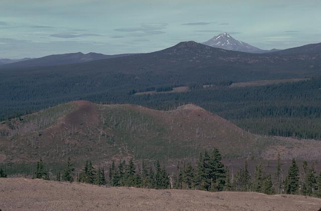
English: The Sand Mountain volcanic field contains a group of 23 cinder cones erupted along a N-S line NW of Mount Washington.
|
|||
| Date | ||||
| Source | http://www.volcano.si.edu/world/volcano.cfm?vnum=1202-04-&volpage=photos&photo=030029 | |||
| Author | Lee Siebert (Smithsonian Institution) | |||
| Permission (Reusing this file) |
|
File history
Click on a date/time to view the file as it appeared at that time.
| Date/Time | Thumbnail | Dimensions | User | Comment | |
|---|---|---|---|---|---|
| current | 16:00, 27 May 2010 | | 640 × 422 (32 KB) | Michael Metzger (talk | contribs) | {{Information |Description={{en|1=The Sand Mountain volcanic field contains a group of 23 cinder cones erupted along a N-S line NW of Mount Washington. Two cone alignments diverge at the highest cone, Sand Mountain; this view looks along the NNE alignment |
You cannot overwrite this file.
File usage on Commons
There are no pages that use this file.
File usage on other wikis
The following other wikis use this file:
- Usage on de.wikipedia.org
- Usage on en.wikipedia.org
- Usage on no.wikipedia.org
- Usage on pt.wikipedia.org
- Usage on www.wikidata.org