File:Samuel Mikovíny - Plan der zwischen Tata, Almás und Szőny liegenden Moresten.jpg
Jump to navigation
Jump to search

Size of this preview: 800 × 412 pixels. Other resolutions: 320 × 165 pixels | 640 × 329 pixels | 1,024 × 527 pixels | 1,280 × 659 pixels | 3,316 × 1,706 pixels.
Original file (3,316 × 1,706 pixels, file size: 4.15 MB, MIME type: image/jpeg)
Captions
Captions
Add a one-line explanation of what this file represents
| Description |
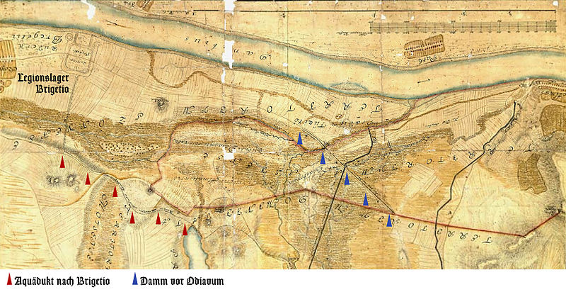
Deutsch: Zeichnung aus: Samuel Mikovíny: „Plan der zwischen Tata, Almás und Szőny liegenden Moresten.
Den ursprung derselben so wohl, als auch mögliche ausdrückerung vorstellend.“ |
| Date | or a little bit later |
| Source | István Viczián I., Friderika Horváth: Brigetio (Ószőny) – Azaum (Almásfüzitő) limesszakaszának római kori emlékei a terület geomorfológiai viszonyainak tükrében. In: György Füleky (Hrsg.): A táj változásai a Kárpát-medencében. Víz a tájban. Gödöllő 2005. S. 223–226. |
| Author | Samuel Mikovíny |
|
This work is in the public domain in its country of origin and other countries and areas where the copyright term is the author's life plus 100 years or fewer. | |
| This file has been identified as being free of known restrictions under copyright law, including all related and neighboring rights. | |
File history
Click on a date/time to view the file as it appeared at that time.
| Date/Time | Thumbnail | Dimensions | User | Comment | |
|---|---|---|---|---|---|
| current | 23:29, 5 July 2012 | | 3,316 × 1,706 (4.15 MB) | Mediatus (talk | contribs) | {{Information |Description ={{de|1=Plan der zwischen Tata, Almás und Szőny liegenden Moresten. }} |Source ={{own}} |Author =Mediatus |Date = |Permission = |other_versions = }} |
You cannot overwrite this file.
File usage on Commons
There are no pages that use this file.
File usage on other wikis
The following other wikis use this file:
- Usage on de.wikipedia.org
- Usage on hu.wikipedia.org
- Usage on it.wikipedia.org