File:Sachsen-Anhalt Landesteile Beschriftet.png
Jump to navigation
Jump to search
Size of this preview: 582 × 599 pixels. Other resolutions: 233 × 240 pixels | 466 × 480 pixels | 746 × 768 pixels | 1,096 × 1,128 pixels.
Original file (1,096 × 1,128 pixels, file size: 30 KB, MIME type: image/png)
Captions
Captions
Add a one-line explanation of what this file represents
Summary[edit]
| Description |
Deutsch:
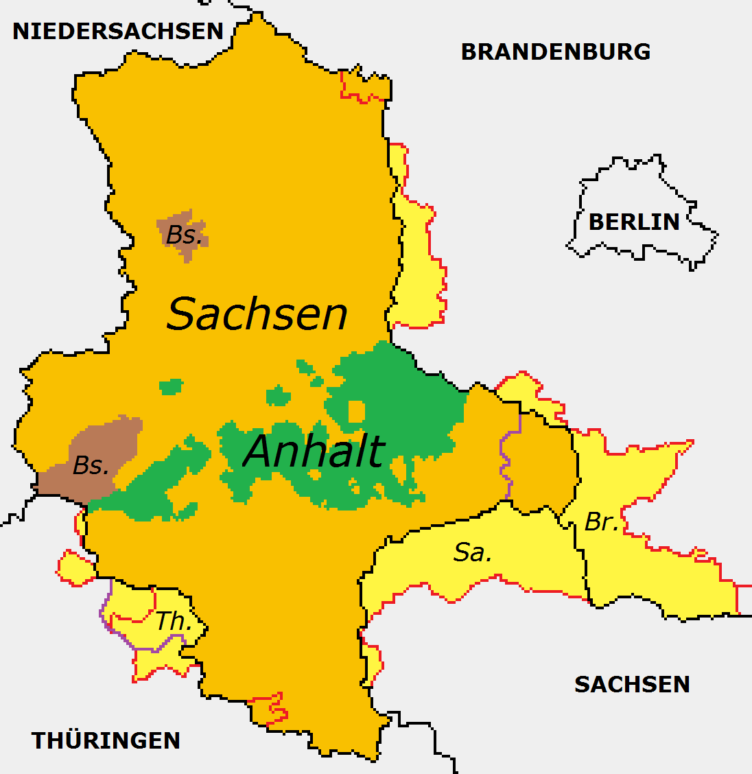
GRENZEN schwarz = aktuell/heute (BRD) LANDESTEILE grün = Anhalt braun = Braunschweig English: BORDERS black = current/today (BRD) REGIONS green = Anhalt brown = Braunschweig (Brunswik) |
| Date | |
| Source | File:Germany_Laender_1947_1990_DDR.png |
| Author | User:Zinoural, basierend auf Werk von User:Kirk und User:Ulamm |
Licensing[edit]
This file is licensed under the Creative Commons Attribution-Share Alike 3.0 Unported license.
- You are free:
- to share – to copy, distribute and transmit the work
- to remix – to adapt the work
- Under the following conditions:
- attribution – You must give appropriate credit, provide a link to the license, and indicate if changes were made. You may do so in any reasonable manner, but not in any way that suggests the licensor endorses you or your use.
- share alike – If you remix, transform, or build upon the material, you must distribute your contributions under the same or compatible license as the original.
File history
Click on a date/time to view the file as it appeared at that time.
| Date/Time | Thumbnail | Dimensions | User | Comment | |
|---|---|---|---|---|---|
| current | 13:40, 19 August 2014 | | 1,096 × 1,128 (30 KB) | Zinoural (talk | contribs) | Better compression. |
| 13:20, 19 August 2014 |  | 1,096 × 1,128 (35 KB) | Zinoural (talk | contribs) | User created page with UploadWizard |
You cannot overwrite this file.
File usage on Commons
The following page uses this file:
File usage on other wikis
The following other wikis use this file:
- Usage on de.wikipedia.org
- Usage on fr.wikipedia.org
- Usage on sv.wikipedia.org
Metadata
Categories:
- Saxony-Anhalt in the 20th century
- Maps of Anhalt
- Magdeburg District (GDR)
- Halle District (GDR)
- Maps of Saxony Province
- Maps of the history of Saxony-Anhalt
- Maps of the history of Saxony
- Territorial changes in Saxony
- Maps of the history of Brandenburg
- Maps of the history of Thuringia
- Halle (region)
- Land Sachsen-Anhalt (1947–1952)