File:SSAC-map.png
Jump to navigation
Jump to search

Size of this preview: 800 × 520 pixels. Other resolutions: 320 × 208 pixels | 640 × 416 pixels | 1,024 × 665 pixels | 1,513 × 983 pixels.
Original file (1,513 × 983 pixels, file size: 39 KB, MIME type: image/png)
Captions
Captions
Add a one-line explanation of what this file represents

|
This sport map image could be re-created using vector graphics as an SVG file. This has several advantages; see Commons:Media for cleanup for more information. If an SVG form of this image is available, please upload it and afterwards replace this template with
{{vector version available|new image name}}.
It is recommended to name the SVG file “SSAC-map.svg”—then the template Vector version available (or Vva) does not need the new image name parameter. |
Summary[edit]
| Description |
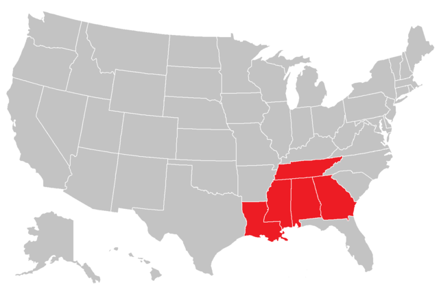
English: map for SSAC NAIA conference |
| Date | (UTC) |
| Source | I (Dgreco (talk)) created this work entirely by myself. |
| Author | Dgreco (talk) |
Licensing[edit]
I, the copyright holder of this work, hereby publish it under the following licenses:
This file is licensed under the Creative Commons Attribution-Share Alike 3.0 Unported license.
- You are free:
- to share – to copy, distribute and transmit the work
- to remix – to adapt the work
- Under the following conditions:
- attribution – You must give appropriate credit, provide a link to the license, and indicate if changes were made. You may do so in any reasonable manner, but not in any way that suggests the licensor endorses you or your use.
- share alike – If you remix, transform, or build upon the material, you must distribute your contributions under the same or compatible license as the original.

|
Permission is granted to copy, distribute and/or modify this document under the terms of the GNU Free Documentation License, Version 1.2 or any later version published by the Free Software Foundation; with no Invariant Sections, no Front-Cover Texts, and no Back-Cover Texts. A copy of the license is included in the section entitled GNU Free Documentation License. |
You may select the license of your choice.
Original upload log[edit]
Transferred from en.wikipedia to Commons by Grondemar.
The original description page was here. All following user names refer to en.wikipedia.
Upload date | User | Bytes | Dimensions | Comment
- 2010-02-16 18:07:19 | Bullshark44 | 37215 | 841×580 | correct alignment
- 2009-12-01 22:01:28 | Bullshark44 | 37215 | 841×580 | updated map
- 2009-11-28 15:21:52 | Bullshark44 | 37211 | 841×580 | {{Information |Description = map for SSAC NAIA conference |Source = I (~~~) created this work entirely by myself. |Date = ~~~~~ |Author = ~~~ |other_versions = }}
File history
Click on a date/time to view the file as it appeared at that time.
| Date/Time | Thumbnail | Dimensions | User | Comment | |
|---|---|---|---|---|---|
| current | 15:29, 4 September 2014 | | 1,513 × 983 (39 KB) | Dafoeberezin3494 (talk | contribs) | Remove South Carolina, remove divisions |
| 02:43, 9 January 2012 |  | 841 × 580 (36 KB) | Grondemar (talk | contribs) | == Summary == {{Information |Description = {{en|map for SSAC NAIA conference}} |Source = I (Dgreco (talk)) created this work entirely by myself. (Originally uploaded on en.wikipedia) |Date = 15:21, 28 November |
You cannot overwrite this file.
File usage on Commons
There are no pages that use this file.
File usage on other wikis
The following other wikis use this file:
- Usage on en.wikipedia.org
- Usage on fr.wikipedia.org