File:S. 134 Karte Dettelbach, Schwarzenau, Henneberg.jpg
Jump to navigation
Jump to search

Size of this preview: 800 × 599 pixels. Other resolutions: 320 × 240 pixels | 640 × 480 pixels | 1,024 × 767 pixels | 1,280 × 959 pixels | 2,560 × 1,918 pixels | 3,386 × 2,537 pixels.
Original file (3,386 × 2,537 pixels, file size: 1.26 MB, MIME type: image/jpeg)
Captions
Captions
Add a one-line explanation of what this file represents
Summary
[edit]
| Description |
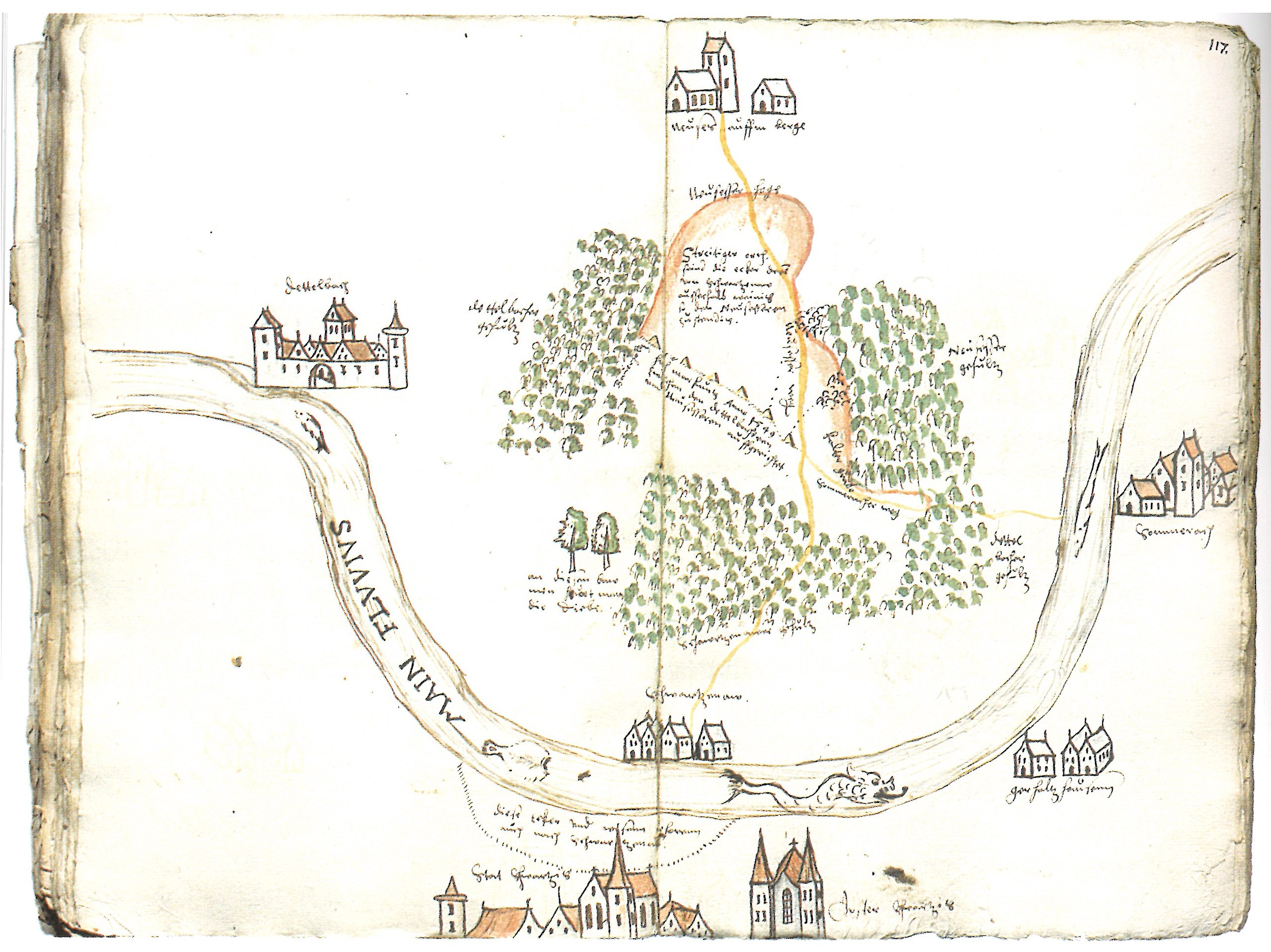
Deutsch: Karte über Gemarkungsstreitigkeiten zwischen Schwarzenau und den Nachbarorten am Maindreieck in Unterfranken. U. a.: Dettelbach, Neuses am Berg, Sommerach, Stadtschwarzach, Münster-Schwarzach, Schwarzenau unten im Mittelpunkt. LATH, StAM, Hennebergica Gotha 654 Bl. 116 v 117 r |
| Date | |
| Source | Johannes Mötsch: Schwarzenau am Main - Ein hennebergisches Lehen. In: Hennebergisch-Fränkischer Geschichtsverein. Jahrbuch 2019 Bd. 34. Meiningen 2019. S. 129-149. hier: S. 134. |
| Author | unbekannt, um 1581 |
Licensing
[edit]
|
This work is in the public domain in its country of origin and other countries and areas where the copyright term is the author's life plus 100 years or fewer. | |
| This file has been identified as being free of known restrictions under copyright law, including all related and neighboring rights. | |
File history
Click on a date/time to view the file as it appeared at that time.
| Date/Time | Thumbnail | Dimensions | User | Comment | |
|---|---|---|---|---|---|
| current | 07:16, 11 March 2020 | | 3,386 × 2,537 (1.26 MB) | Monandowitsch (talk | contribs) | Uploaded a work by unbekannt, um 1581 from Johannes Mötsch: Schwarzenau am Main - Ein hennebergisches Lehen. In: Hennebergisch-Fränkischer Geschichtsverein. Jahrbuch 2019 Bd. 34. Meiningen 2019. S. 129-149. hier: S. 134. with UploadWizard |
You cannot overwrite this file.
File usage on Commons
The following page uses this file:
File usage on other wikis
The following other wikis use this file:
- Usage on de.wikipedia.org