File:Rubbish dumped in Havelock Road N17 (38011648792).jpg

Original file (4,000 × 3,000 pixels, file size: 4.36 MB, MIME type: image/jpeg)
Captions
Captions
Summary[edit]
.jpg&action=edit§ion=1)
| Description |
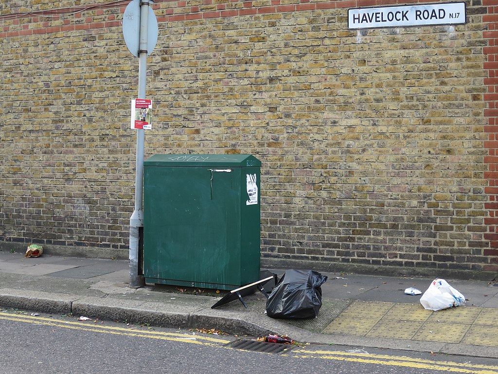
29 October 2017. Photo by Martin Ball of rubbish dumped on the pavement in Havelock Road, Tottenham N17 near the T-junction with Rosebery Avenue. Posted here with his permission. I reported it to Haringey Council using the the free website <a href="https://www.fixmystreet.com/report/1135409" rel="noreferrer nofollow">Fix My Street</a>. Closure of the Reuse & Recycling Centre Some local residents have been worried about the impact of the closure of the Reuse & Reycling Centre in Park View Road Tottenham, on 23 October 2017. There is now no such Centre on the East (Tottenham) side of Haringey borough. The Centre was not only for recycling, It was also a place to bring general waste. In other words what people elsewhere sometimes call their "dump" or "tip" - for stuff which won't fit into the general waste bins collected from residents' homes. Not a new problem Street dumping has been a long-standing problem in Haringey. As I've photographed and posted for many years, there's a culture of dumping which has never been effectively tackled by our elected borough Council. When the Council announced that Park View Road Reuse & Reycling Centre was to close, I'd guess there were residents living close-by who may have welcomed this - at least on balance. They've suffered dumping in their streets - perhaps by a few drivers who arrived at the Centre after hours. On the other hand, many other residents - including me and my wife Zena Brabazon - worry that this and other changes to waste management could result in worse dumping. Not just on streets near Park View Road but far more widely. Haringey has a very poor record for "fly-tipping" - meaning reported incidents of rubbish dumping. The Council's knee-jerk defence Faced with such criticisms some of our councillors repeat the explanation/excuse that everything is the fault of the National Government and its "austerity" policy. They tell us that closure of Park View Road Centre is one of the "savings" they have been forced to make. (Many of them prefer this weasel word instead of truthfully referring to "cuts".) The impact of the Governments cuts on local authority funding is true. Very substantially true. But not the whole picture. Sometimes children doing something naughty say that "big" girls and boys "made them do it". So it's convenient for the "leaders" of Haringey Council to pretend that decisions have been entirely taken out of their hands by the nasty Government. I wish that, just for once, they had the honesty to admit that some of their own decisions were mistaken. That they made unwise and even bad choices which have harmful and costly consequences for the people who elect them. I wish they had the integrity and humility to take personal responsibility for their own judgement about which areas to cut and which to protect. About which new projects are funded and which front-line services are lost. About which foolish and ill-advised vanity projects took priority. I wish they had the courage to admit how many highly paid "interim" staff, consultants, lawyers and others they've hired needlessly to push forward, publicise and defend costly and wasteful mistakes, dud decisions and poor management. And to tell the truth and learn from each failure, instead of themselves or their "Comms" Team story-telling it as success. __________________________________ § This location on Havelock Road N17 <a href="https://www.google.co.uk/maps/@51.5965125,-0.060373,3a,81.7y,226.92h,75.84t/data=!3m6!1e1!3m4!1s6KaGR7sslQDzUqVY8xoumQ!2e0!7i13312!8i6656" rel="noreferrer nofollow">with Google Maps</a>. |
| Date | |
| Source | Rubbish dumped in Havelock Road N17 |
| Author | Alan Stanton |
| Camera location | | View this and other nearby images on: OpenStreetMap |
|---|
.jpg¶ms=051.596599_N_-000.060427_E_globe:Earth_type:camera_source:Flickr_&language=en)
Licensing[edit]
.jpg&action=edit§ion=2)
- You are free:
- to share – to copy, distribute and transmit the work
- to remix – to adapt the work
- Under the following conditions:
- attribution – You must give appropriate credit, provide a link to the license, and indicate if changes were made. You may do so in any reasonable manner, but not in any way that suggests the licensor endorses you or your use.
- share alike – If you remix, transform, or build upon the material, you must distribute your contributions under the same or compatible license as the original.
| This image was originally posted to Flickr by Alan Stanton at https://flickr.com/photos/53921762@N00/38011648792. It was reviewed on 8 December 2020 by FlickreviewR 2 and was confirmed to be licensed under the terms of the cc-by-sa-2.0. |
File history
Click on a date/time to view the file as it appeared at that time.
| Date/Time | Thumbnail | Dimensions | User | Comment | |
|---|---|---|---|---|---|
| current | 19:29, 8 December 2020 | | 4,000 × 3,000 (4.36 MB) | TheImaCow (talk | contribs) | Transferred from Flickr via #flickr2commons |
You cannot overwrite this file.
File usage on Commons
There are no pages that use this file.
.jpg&oldid=791204261)