File:Ruanda prov 2005 de.svg

Original file (SVG file, nominally 990 × 765 pixels, file size: 804 KB)
Captions
Captions
Summary[edit]
| Description |
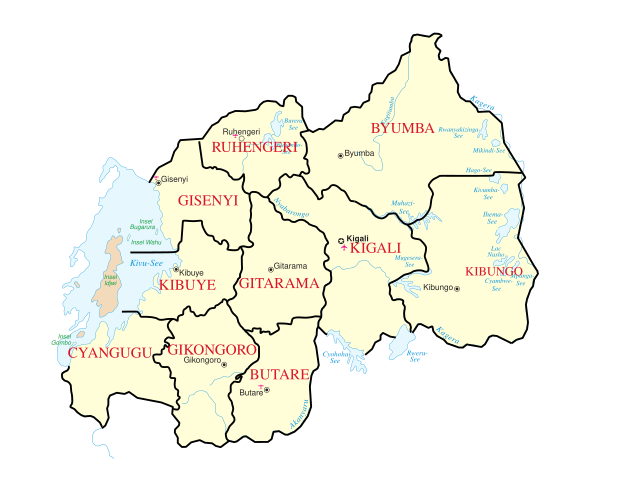
Deutsch: Karte Ruandas vor Verwaltungsreform im Jahr 2006 Provinzansicht English: Map of Rwanda before administrative reform of 2006 (privince view) |
||||||
| Date | |||||||
| Source | File:Un-rwanda.png http://www.un.org/Depts/Cartographic/english/htmain.htm | ||||||
| Author | Image:Ruanda deutsch UNO-Karte.jpg + UN Original changed to SVG + new province | ||||||
| Other versions |
|
||||||
| SVG development |


Licensing[edit]
| This image is a map derived from a United Nations map.
Unless stated otherwise, UN maps are to be considered in the public domain. This applies worldwide. UN maps are, in principle, open source material and you can use them in your work or for making your own map. UN requests however that you delete the UN name, logo and reference number upon any modification to the map. Content of your map will be your responsibility. You can state in your publication, if you wish, something like: based on UN map … (map name, map number, revision number and date). See: Geospatial Information Section. And: Geospatial, location data for a better world. |
 |
File history
Click on a date/time to view the file as it appeared at that time.
| Date/Time | Thumbnail | Dimensions | User | Comment | |
|---|---|---|---|---|---|
| current | 12:21, 14 October 2008 | | 990 × 765 (804 KB) | FischX (talk | contribs) | Reverted to version as of 02:06, 26 February 2008 |
| 12:21, 14 October 2008 |  | 990 × 765 (813 KB) | FischX (talk | contribs) | Reverted to version as of 01:57, 26 February 2008 | |
| 02:06, 26 February 2008 |  | 990 × 765 (804 KB) | FischX (talk | contribs) | Workaround upload disp. SVG | |
| 01:57, 26 February 2008 |  | 990 × 765 (813 KB) | FischX (talk | contribs) | {{Information |Description= Karte Ruandas vor Verwaltungsreform im Jahr 2006 Provinzansicht / Map of Rwanda before administrative reform of 2006 (privince view) |Source= http://commons.wikimedia.org/wiki/Image:Un-rwanda.png http://www.un.org/Depts/Cartog |
You cannot overwrite this file.
File usage on Commons
The following 2 pages use this file: