File:Romania 1930, Administrative Map.svg
Jump to navigation
Jump to search

Size of this PNG preview of this SVG file: 721 × 561 pixels. Other resolutions: 309 × 240 pixels | 617 × 480 pixels | 987 × 768 pixels | 1,280 × 996 pixels | 2,560 × 1,992 pixels.
Original file (SVG file, nominally 721 × 561 pixels, file size: 1.08 MB)
Captions
Captions
Add a one-line explanation of what this file represents
Summary[edit]
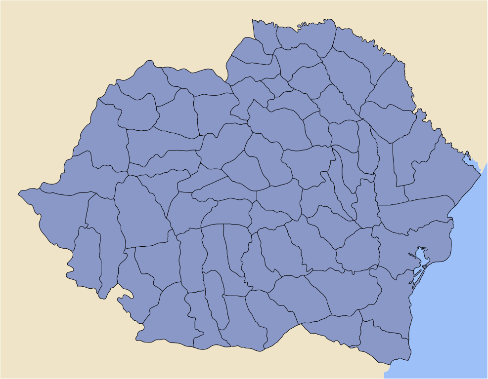
| Description | Administrative map of Romania in 1930. |
| Date | |
| Source | Image:Romania interwar counties.jpg |
| Author | Cornel-Constantin Ilie |
| Permission (Reusing this file) |
Public Domain |
| Kingdom of Romania (1918–1940) Administrative Map. |
Harta administrativă a Regatului României (1918–1940). |
| This picture is featuring Image:Romania interwar counties.jpg. The source mentioned image is a scanned picture, upon an older-than-70-years romanian book (70 years is the deadline impose by Romanian Copyright Act; it is legal to reproduce sources older than 70 years). The source image is also released in Public Domain. | Această imagine este creată folosind Image:Romania interwar counties.jpg. Imaginea sursă menționată este o scanare dintr-o carte românească mai veche de 70 de ani (70 de ani este termenul limită impus de legea drepturilor de autor din România; este legală reproducerea surselor mai vechi de 70 de ani). De asemeni, imaginea sursă este oferită Domeniului Public. |
| This SVG file was created using Inkscape. It contains layers that can help obtaining various kind of sketches (i.e., one county highlighted with respect to the rest of administrative subdivisions). |
Aceast fișier SVG a fost creat folosind programul Inkscape (pagină în engleză). Fișierul conține folii (layers) care pot fi de mare ajutor la obținerea diverselor schițe. |
| A special care was paid for Colour Map. The Colour Map used is consistent with Map of Transylvania properly highlighted. | O preocupare importantă a fost coloritul schiței. Scara de culori folosită a fost insiprată din harta corectă a Transilvaniei. |
| This image is released to Public Domain. | Această imagine este oferită în Domeniul Public. |
| Author: Cornel Ilie | Autor: Cornel Ilie |
Licensing[edit]
| I, the copyright holder of this work, release this work into the public domain. This applies worldwide. In some countries this may not be legally possible; if so: I grant anyone the right to use this work for any purpose, without any conditions, unless such conditions are required by law. |
File history
Click on a date/time to view the file as it appeared at that time.
| Date/Time | Thumbnail | Dimensions | User | Comment | |
|---|---|---|---|---|---|
| current | 23:12, 11 March 2006 | | 721 × 561 (1.08 MB) | Cornel commons (talk | contribs) | Kingdom of Romania, as of 1930, administrative map; SVG file (mk3, properly fit in page). |
| 01:09, 25 February 2006 |  | 744 × 1,052 (821 KB) | Cornel commons (talk | contribs) | Map of Counties of Romania at 1930, make upon a Public Domain image ([:Image:Judetele_Romaniei_interbelice.JPG]). |
You cannot overwrite this file.
File usage on Commons
The following page uses this file:
File usage on other wikis
The following other wikis use this file:
- Usage on en.wikipedia.org
- Usage on ro.wikipedia.org