File:Rogue river access map.png
Jump to navigation
Jump to search
Size of this preview: 298 × 598 pixels. Other resolutions: 119 × 240 pixels | 239 × 480 pixels | 958 × 1,923 pixels.
Original file (958 × 1,923 pixels, file size: 577 KB, MIME type: image/png)
Captions
Captions
Add a one-line explanation of what this file represents
| Description |
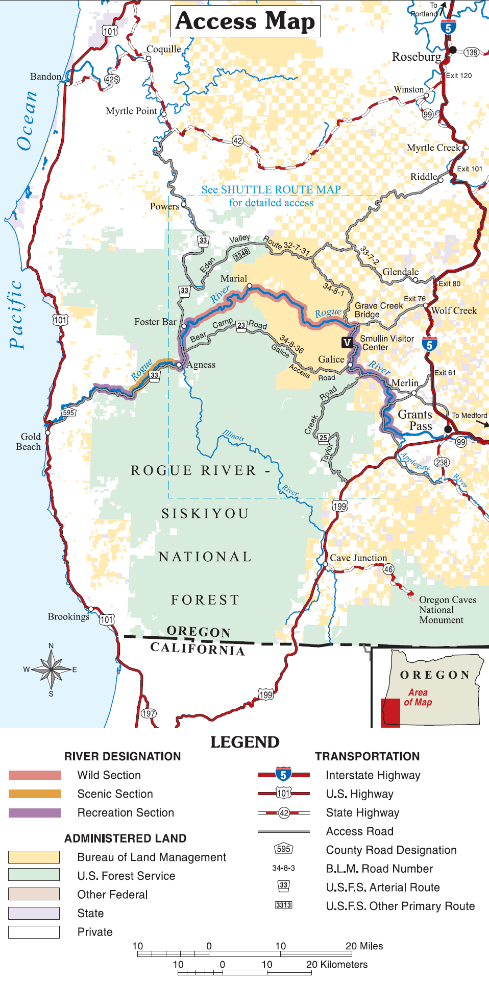
Map of the western course of the Rogue River, with access locations — in southwestern Oregon.
|
| Date | uploaded to wikipedia by w:User:EncMstr 17:16, 16 August 2006 |
| Source | Rogue River Float Guide—w:Image:Rogue river access map.png |
| Author | Bureau of Land Management and US Forest Service |
This image is a work of the Forest Service of the United States Department of Agriculture. As a work of the U.S. federal government, the image is in the public domain.
|
File history
Click on a date/time to view the file as it appeared at that time.
| Date/Time | Thumbnail | Dimensions | User | Comment | |
|---|---|---|---|---|---|
| current | 09:30, 29 September 2007 | | 958 × 1,923 (577 KB) | CarolSpears (talk | contribs) | {{Information |Description=Map of access points and route overview of Rogue River, Oregon from Rogue River Float Guide |Source=w:Image:Rogue river access map.png |Date= uploaded to wikipedia by w:User:EncMstr 17:16, 16 August 2006 |Author=Bureaa o |
You cannot overwrite this file.
File usage on Commons
The following page uses this file:
File usage on other wikis
The following other wikis use this file:
- Usage on cs.wikipedia.org
- Usage on de.wikipedia.org
- Usage on en.wikipedia.org
- Usage on es.wikipedia.org
- Usage on he.wikipedia.org
- Usage on nl.wikipedia.org
- Usage on ru.wikipedia.org
- Usage on www.wikidata.org