File:Road map around Lincoln Memorial - 1950.jpg
Jump to navigation
Jump to search
Size of this preview: 596 × 600 pixels. Other resolutions: 238 × 240 pixels | 477 × 480 pixels | 763 × 768 pixels | 1,017 × 1,024 pixels | 1,364 × 1,373 pixels.
Original file (1,364 × 1,373 pixels, file size: 379 KB, MIME type: image/jpeg)
Captions
Captions
Add a one-line explanation of what this file represents
Summary
[edit]
| Description |
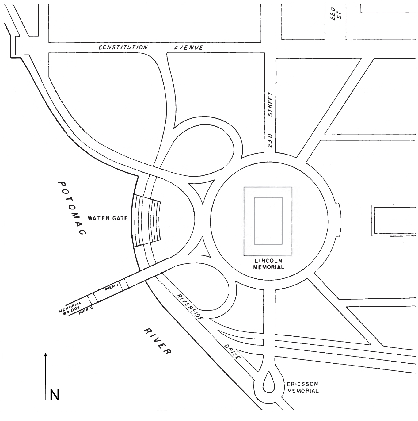
English: Map showing the roads, bridges, underpasses, and other features around the Lincoln Memorial in 1950 in Washington, D.C., in the United States.
Note that in 1956, Constitution Avenue NW would be severed from its western terminus so that on-ramps and off-ramps could be built to connect with the as-yet-unbuilt Theodore Roosevelt Memorial Bridge. Riverside Drive would later be renamed Ohio Drive. Notable nearby memorials such as the Vietnam Veterans Memorial and the Korean War Veterans Memorial would not be constructed until the 1980s and 1990s. |
| Date | |
| Source | http://pubs.usgs.gov/pp/0217/report.pdf |
| Author | Darton, N.H. Configuration of the Bedrock Surface of the District of Columbia and Vicinity. Geological Survey Professional Paper No. 217. Washington, D.C.: U.S. Government Printing Office, 1950, p. 24 |
Original map showed surface topography lines, and bedrock borings and depths. These have been removed from this version of the map.
Licensing
[edit]
This file is a work of a U.S. Army soldier or employee, taken or made as part of that person's official duties. As a work of the U.S. federal government, it is in the public domain in the United States.
|
 |
File history
Click on a date/time to view the file as it appeared at that time.
| Date/Time | Thumbnail | Dimensions | User | Comment | |
|---|---|---|---|---|---|
| current | 16:13, 5 May 2013 | | 1,364 × 1,373 (379 KB) | Tim1965 (talk | contribs) | {{Information |Description ={{en|1=Map showing the roads, bridges, underpasses, and other features around the Lincoln Memorial in 1950 in Washington, D.C., in the United States. Note that in 1956, Constitution Avenue NW would be severed from its we... |
You cannot overwrite this file.
File usage on Commons
There are no pages that use this file.