File:River Nile map de.svg
Jump to navigation
Jump to search

Size of this PNG preview of this SVG file: 475 × 599 pixels. Other resolutions: 190 × 240 pixels | 381 × 480 pixels | 609 × 768 pixels | 812 × 1,024 pixels | 1,624 × 2,048 pixels | 636 × 802 pixels.
Original file (SVG file, nominally 636 × 802 pixels, file size: 138 KB)
Captions
Captions
Add a one-line explanation of what this file represents
Summary
[edit]| Description |
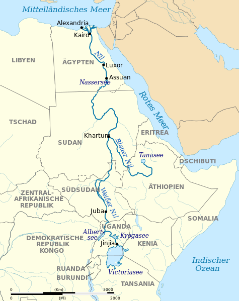
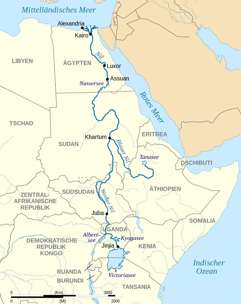
Deutsch: Verlauf des Nil mit den Quellflüssen Weißer und Blauer Nil.
English: Map of the River Nile with White and Blue Nile. |
||
| Date | |||
| Source |
This file was derived from: River Nile map.svg by Hel-hama |
||
| Author |
|
||
| Permission (Reusing this file) |
I, the copyright holder of this work, hereby publish it under the following licenses:
This file is licensed under the Creative Commons Attribution-Share Alike 4.0 International license.
You may select the license of your choice. |
||
| Other versions |
|
||
| SVG development | This map was created with Adobe Illustrator. |


File history
Click on a date/time to view the file as it appeared at that time.
| Date/Time | Thumbnail | Dimensions | User | Comment | |
|---|---|---|---|---|---|
| current | 14:36, 17 April 2023 | | 636 × 802 (138 KB) | Ispanas (talk | contribs) | File uploaded using svgtranslate tool (https://svgtranslate.toolforge.org/). Added translation for lt. |
| 10:35, 5 July 2020 |  | 636 × 802 (130 KB) | Furfur (talk | contribs) | Details | |
| 10:17, 5 July 2020 |  | 636 × 802 (130 KB) | Furfur (talk | contribs) | Schriftgrößen | |
| 10:03, 5 July 2020 |  | 636 × 802 (130 KB) | Furfur (talk | contribs) | == {{int:filedesc}} == {{Information |Description={{User:Medium69/Traduction}} {{de|1=Verlauf des Nil mit den Quellflüssen Weißer und Blauer Nil.}} {{en|1=Map of the River Nile with White and Blue Nile.}} |Source={{Derived from|River Nile map.svg|by=Hel-hama}} |Date=2020-06-05 |Author=* River Nile map.svg: {{U|Hel-hama}} *this file: {{U|Furfur}} |Permission={{self|GFDL|cc-by-sa-4.0}} |Other versions=<gallery> File:River Nile map.svg|<center>{{Language|en}}</center... |
You cannot overwrite this file.
File usage on Commons
The following 5 pages use this file:
File usage on other wikis
The following other wikis use this file:
- Usage on de.wikipedia.org
- Usage on lt.wikipedia.org
- Usage on rm.wikipedia.org