File:River Lemon Valley Woods SSSI.png
Jump to navigation
Jump to search
Size of this preview: 750 × 600 pixels. Other resolutions: 300 × 240 pixels | 600 × 480 pixels | 960 × 768 pixels | 1,280 × 1,024 pixels | 1,490 × 1,192 pixels.
Original file (1,490 × 1,192 pixels, file size: 519 KB, MIME type: image/png)
Captions
Captions
Add a one-line explanation of what this file represents
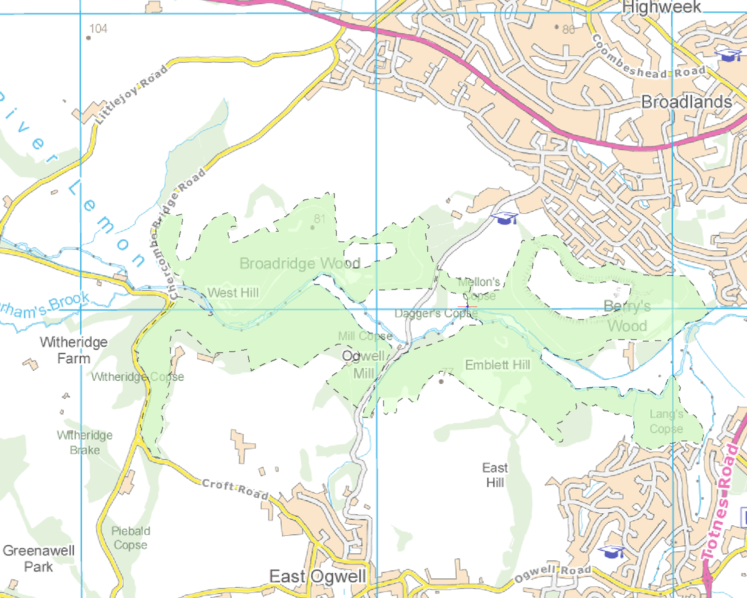
| Description | Map showing the River Lemon Valley Woods SSSI, near Newton Abbot in Devon, UK. |
| Date | |
| Source | Own work |
| Author | Nilfanion, using Ordnance Survey and Natural England data |
| Permission (Reusing this file) |
This file is licensed under the Creative Commons Attribution-Share Alike 3.0 Unported license. Attribution: © Natural England copyright 2012. Contains Ordnance Survey data © Crown copyright and database right 2012
|
File history
Click on a date/time to view the file as it appeared at that time.
| Date/Time | Thumbnail | Dimensions | User | Comment | |
|---|---|---|---|---|---|
| current | 22:00, 19 April 2012 | | 1,490 × 1,192 (519 KB) | Nilfanion (talk | contribs) | {{Information |Description=Map showing the River Lemon Valley Woods SSSI, near Newton Abbot in Devon, UK. |Source={{own}} |Date=2012-04-19 |Author= Nilfanion, using Ordnance Survey and Natural England data |Permission={{cc-by-sa-3.0|... |
You cannot overwrite this file.
File usage on Commons
There are no pages that use this file.