File:Relief map of Crimea.jpg
Jump to navigation
Jump to search
Size of this preview: 800 × 542 pixels. Other resolutions: 320 × 217 pixels | 640 × 434 pixels | 1,024 × 694 pixels | 1,200 × 813 pixels.
Original file (1,200 × 813 pixels, file size: 194 KB, MIME type: image/jpeg)
Captions
Captions
Add a one-line explanation of what this file represents
Summary[edit]
| Description |
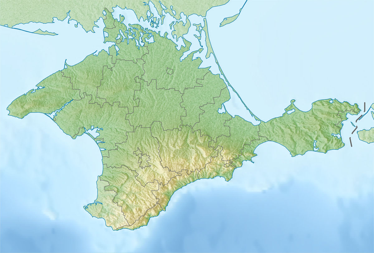
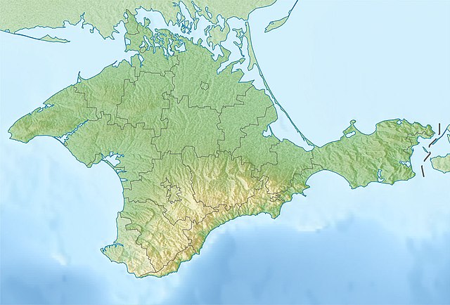
Русский: Физическая карта Автономной Республики Крым
Равноугольная проекция, стандартная параллель — 45°15′с.ш. Параметры шаблона (координаты краёв): English: Physical map of the Autonomous Republic of Crimea
Conformal projection, standard parallels — 45°15's.W. Template parameters (coordinates of the edges):
|
| Date | |
| Source | |
| Author |
|
| This is a retouched picture, which means that it has been digitally altered from its original version. The original can be viewed here: Outline Map of Crimea.svg:
|
Licensing[edit]
I, the copyright holder of this work, hereby publish it under the following license:
| I, the copyright holder of this work, release this work into the public domain. This applies worldwide. In some countries this may not be legally possible; if so: I grant anyone the right to use this work for any purpose, without any conditions, unless such conditions are required by law. |
Original upload log[edit]
This image is a derivative work of the following images:
- File:Outline_Map_of_Crimea.svg licensed with PD-self
- 2010-12-06T19:49:04Z Виктор В 1000x678 (74604 Bytes) == {{int:filedesc}} == {{Information |Description={{ru|1=Позиционная карта Автономной Республики КрымРавноугольная проекция, стандартная параллел
Uploaded with derivativeFX
File history
Click on a date/time to view the file as it appeared at that time.
| Date/Time | Thumbnail | Dimensions | User | Comment | |
|---|---|---|---|---|---|
| current | 23:01, 6 January 2016 | | 1,200 × 813 (194 KB) | Janitoalevic (talk | contribs) | Found another version that is the change that i made File:Relief_map_of_Crimea_(disputed_status).jpg |
| 22:53, 6 January 2016 |  | 1,200 × 813 (416 KB) | Janitoalevic (talk | contribs) | Neutrality of the map, just physical map. | |
| 19:41, 7 December 2010 |  | 1,200 × 813 (194 KB) | Виктор В (talk | contribs) | {{Information |Description={{ru|1=Физическая карта Автономной Республики Крым<br>Равноугольная проекция, стандартная параллель — 45°15′с.ш.<br>Параметры шаб |
You cannot overwrite this file.
File usage on Commons
The following 43 pages use this file:
- Crimea
- Category:Administrative division in Crimean peninsula
- Category:Airports in Crimea
- Category:Ancient history of Crimea
- Category:Archaeology in Crimea
- Category:Architecture of Crimea
- Category:Association football clubs in Crimea
- Category:Autonomous Republic of Crimea
- Category:Awards of Crimea
- Category:Bodies of water in Crimea
- Category:Churches in Crimea
- Category:Companies based in Crimea
- Category:Crimea
- Category:Crimea by century
- Category:Crimea in the 19th century
- Category:Crimea in the 20th century
- Category:Eastern Orthodox monasteries in Crimea
- Category:Education in Crimea
- Category:Elections in Crimea
- Category:Events in Crimea
- Category:Geography of Crimea
- Category:Images of Crimea
- Category:Lakes of Crimea
- Category:Lighthouses in Crimea
- Category:Maps of Crimea
- Category:Ministers of the Autonomous Republic of Crimea
- Category:Monasteries in Crimea
- Category:Monuments and memorials in Crimea
- Category:Mosques in Crimea
- Category:Municipalities in Crimea
- Category:Organizations of Crimea
- Category:Politicians of Crimea
- Category:Politicians of the Autonomous Republic of Crimea
- Category:Politics of the Autonomous Republic of Crimea
- Category:Populated places in Crimea
- Category:Raions of the Autonomous Republic of Crimea
- Category:Rural settlements in Crimea
- Category:Sports in Crimea
- Category:Stadiums in Crimea
- Category:Views of Crimea
- Category:Visitor attractions in Crimea
- Category:Water transport in Crimea
- Category:Wind farms in Crimea
File usage on other wikis
The following other wikis use this file:
- Usage on als.wikipedia.org
- Usage on ar.wikipedia.org
- Usage on be.wikipedia.org
- Usage on bg.wikipedia.org
- Севастопол
- Симферопол
- Ялта
- Ливадия (Крим)
- Феодосия
- Керч
- Перекоп
- Судак
- Алупка
- Гаспра
- Алуща
- Евпатория
- Джанкой
- Шаблон:ПК Украйна Крим
- Балаклавски залив
- Стари Крим
- Кишлав
- Балта Чокрак
- Керченски полуостров
- Учан Су (водопад)
- Ялтенска яйла
- Бахчисарай
- Кримски планини
- Мангуп
- Арабатски залив
- Каркинитски залив
- Тарханкутски полуостров
- Красноперекопск
- Черноморское
- Лебедски острови
- Usage on bn.wikipedia.org
View more global usage of this file.