File:Regno di Morea de.svg
Jump to navigation
Jump to search

Size of this PNG preview of this SVG file: 766 × 600 pixels. Other resolutions: 307 × 240 pixels | 613 × 480 pixels | 981 × 768 pixels | 1,280 × 1,002 pixels | 2,560 × 2,005 pixels | 1,785 × 1,398 pixels.
Original file (SVG file, nominally 1,785 × 1,398 pixels, file size: 1.12 MB)
Captions
Captions
Add a one-line explanation of what this file represents
Summary
[edit]| Description |
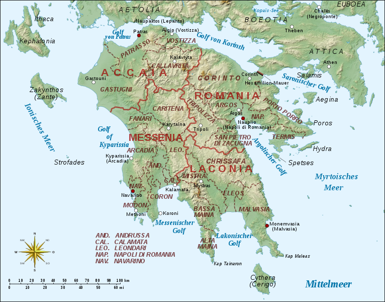
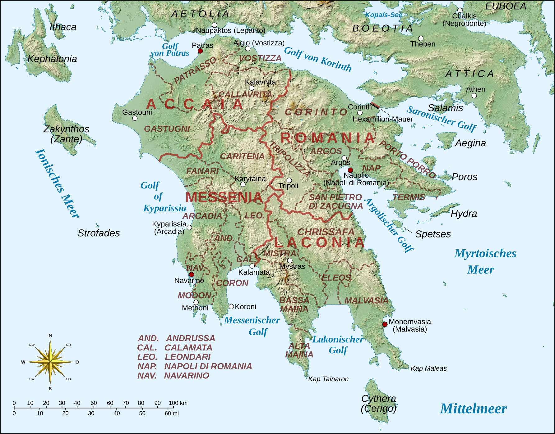
Deutsch: Verwaltungsgliederung des venezianischen Königreichs Morea auf der Peleponnes 1688-1715. Reliefkarte Peloponnese Middle Ages map-en.svg, Informationen aus: Βασίλης Παναγιωτόπουλος, Πληθυσμός και οικισμοί της Πελοποννήσου, 13ος - 18ος αιώνας [Bevölkerung und Siedlungen auf der Peleponnes, 13th-18th Jahrhundert]", Athen 1985, Seite 165. English: The administrative divisions of the Venetian Kingdom of the Morea in the Peloponnese, 1688-1715. Basemap from Peloponnese Middle Ages map-en.svg, information from Βασίλης Παναγιωτόπουλος, Πληθυσμός και οικισμοί της Πελοποννήσου, 13ος - 18ος αιώνας [Population and Settlements in the Peloponnese, 13th-18th Century]", Athens 1985, page 165. |
||
| Date | |||
| Source | Own work | ||
| Author | |||
| Permission (Reusing this file) |
I, the copyright holder of this work, hereby publish it under the following licenses: This file is licensed under the Creative Commons Attribution-Share Alike 3.0 Unported license.
You may select the license of your choice. |

File history
Click on a date/time to view the file as it appeared at that time.
| Date/Time | Thumbnail | Dimensions | User | Comment | |
|---|---|---|---|---|---|
| current | 20:59, 1 October 2016 | | 1,785 × 1,398 (1.12 MB) | Furfur (talk | contribs) | == {{int:filedesc}} == {{Information |Description ={{de|1=Verwaltungsgliederung des venezianischen Königreichs Morea auf der Peleponnes 1688-1715.<br> Reliefkarte [[:File:Peloponnese Middle Ages map-en.svg|Peloponnese Middle Ages map-... |
You cannot overwrite this file.
File usage on Commons
The following page uses this file:
File usage on other wikis
The following other wikis use this file:
- Usage on de.wikipedia.org