File:RbfMannheim Notfallzuwegung.jpg
Jump to navigation
Jump to search

Size of this preview: 800 × 533 pixels. Other resolutions: 320 × 213 pixels | 640 × 427 pixels | 1,024 × 683 pixels | 1,280 × 853 pixels | 1,728 × 1,152 pixels.
Original file (1,728 × 1,152 pixels, file size: 175 KB, MIME type: image/jpeg)
Captions
Captions
Add a one-line explanation of what this file represents
Summary[edit]
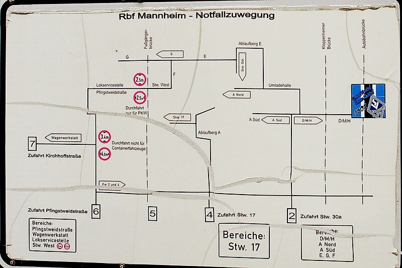
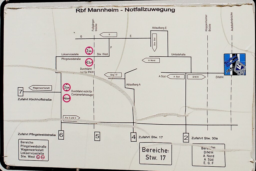
| Description | Plan der Notfallzufahrten im Mannheimer Rangierbahnhof |
| Date | |
| Source | |
| Author | Ikar.us |

| Object location | | View this and other nearby images on: OpenStreetMap |
|---|
I, the copyright holder of this work, hereby publish it under the following license:
This file is licensed under the Creative Commons Attribution 3.0 Germany license.
- You are free:
- to share – to copy, distribute and transmit the work
- to remix – to adapt the work
- Under the following conditions:
- attribution – You must give appropriate credit, provide a link to the license, and indicate if changes were made. You may do so in any reasonable manner, but not in any way that suggests the licensor endorses you or your use.

File history
Click on a date/time to view the file as it appeared at that time.
| Date/Time | Thumbnail | Dimensions | User | Comment | |
|---|---|---|---|---|---|
| current | 19:19, 3 July 2023 | | 1,728 × 1,152 (175 KB) | Ikar.us (talk | contribs) | {{Information |Description=Plan der Notfallzufahrten im Mannheimer Rangierbahnhof |Source={{extracted_from|RbfMannheim_Zufahrt2.jpg}} |Date=2023-02 |Author=Ikar.us }}{{object_location|49.450476|8.531318}} {{self|cc-by-3.0-de}} Category:Rescue points in Germany Category:Mannheim Rangierbahnhof Category:Rail transport signs in Baden-Württemberg |
You cannot overwrite this file.
File usage on Commons
The following 3 pages use this file: