File:Rand McNally & Co's new commercial map of Europe (14960195732) (inset map).jpg
Jump to navigation
Jump to search
Size of this preview: 800 × 532 pixels. Other resolutions: 320 × 213 pixels | 640 × 425 pixels | 1,024 × 680 pixels | 1,280 × 851 pixels | 2,560 × 1,701 pixels | 5,252 × 3,490 pixels.
Original file (5,252 × 3,490 pixels, file size: 3.43 MB, MIME type: image/jpeg)
Captions
Captions
Add a one-line explanation of what this file represents
Summary[edit]
| Description |
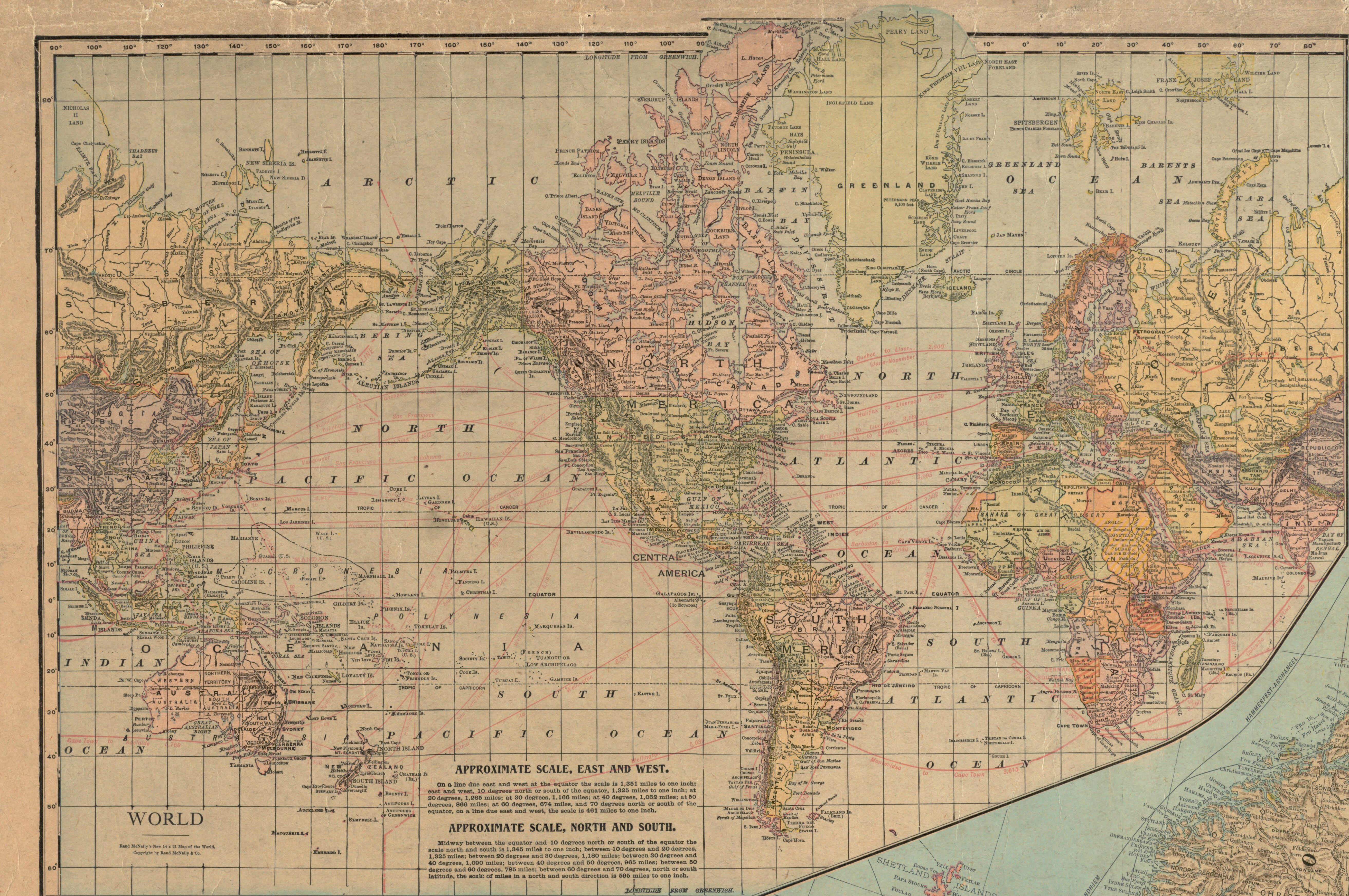
Zoom into this map at maps.bpl.org. Author: Rand McNally and Company Publisher: Rand McNally and Company Date: 1922 Location: Europe Dimensions: 98 x 115 cm Scale: 1:4,561,920 Call Number: G5700 1922 .R36 |
| Date | |
| Source | Rand McNally & Co's new commercial map of Europe |
| Author | Norman B. Leventhal Map Center |
| Other versions |
.jpg)
_(inset_map).jpg&action=edit§ion=1)
Licensing[edit]
_(inset_map).jpg&action=edit§ion=2)
This file is licensed under the Creative Commons Attribution 2.0 Generic license.
- You are free:
- to share – to copy, distribute and transmit the work
- to remix – to adapt the work
- Under the following conditions:
- attribution – You must give appropriate credit, provide a link to the license, and indicate if changes were made. You may do so in any reasonable manner, but not in any way that suggests the licensor endorses you or your use.
File history
Click on a date/time to view the file as it appeared at that time.
| Date/Time | Thumbnail | Dimensions | User | Comment | |
|---|---|---|---|---|---|
| current | 23:18, 31 August 2022 | | 5,252 × 3,490 (3.43 MB) | GPinkerton (talk | contribs) | File:Rand McNally & Co's new commercial map of Europe (14960195732).jpg cropped 66 % horizontally, 71 % vertically using CropTool with lossless mode. |
You cannot overwrite this file.
File usage on Commons
The following page uses this file:
_(inset_map).jpg&oldid=686075586)