File:RamalBAOvar.png
Jump to navigation
Jump to search
Size of this preview: 600 × 600 pixels. Other resolutions: 240 × 240 pixels | 480 × 480 pixels | 722 × 722 pixels.
Original file (722 × 722 pixels, file size: 321 KB, MIME type: image/png)
Captions
Captions
Add a one-line explanation of what this file represents
Summary[edit]
| Description |
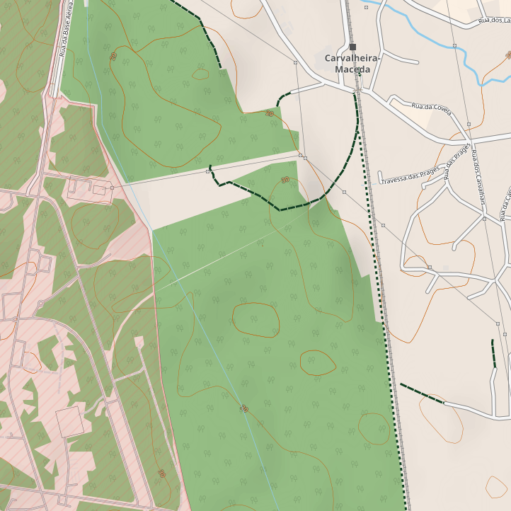
Português: Mapa mostrando os vestígios da ferrovia extinta que servia a Base Aérea de Ovar, em Portugal, ligando à Linha do Norte no Apeadeiro de Carvalheira-Maceda (sentido descendente, de Campanhã). |
| Date | |
| Source | https://www.openstreetmap.org/#map=16/40.9205/-8.6292&layers=Y |
| Author | ⧼OpenStreetMap contributors⧽ |
| 1st uploaded as the | 80,253,585th file in Wikimedia Commons |
Licensing[edit]
| This work contains information from OpenStreetMap, which is made available under the Open Database License (ODbL).
The ODbL does not require any particular license for maps produced from ODbL data. Prior to 1 August 2020, map tiles produced by the OpenStreetMap Foundation were licensed under the CC-BY-SA-2.0 license. Maps produced by other people may be subject to other licences. |
File history
Click on a date/time to view the file as it appeared at that time.
| Date/Time | Thumbnail | Dimensions | User | Comment | |
|---|---|---|---|---|---|
| current | 16:15, 23 January 2022 | | 722 × 722 (321 KB) | Tuvalkin (talk | contribs) | == {{int:filedesc}} == {{Information |Description= {{pt|Mapa mostrando os vestígios da ferrovia extinta que servia a Base Aérea de Ovar, em Portugal, ligando à Linha do Norte no Apeadeiro de Carvalheira-Maceda (sentido descendente, de Campanhã).}} |Source= https://www.openstreetmap.org/#map=16/40.9205/-8.6292&layers=Y |Date= 2022-01-23 |Author= {{int:OpenStreetMap contributors}} |Permission= | Other_versions = | other_fields={{Information_field |name=1st uploaded as the|value={{subst:formatnu... |
You cannot overwrite this file.
File usage on Commons
The following 3 pages use this file:
File usage on other wikis
The following other wikis use this file:
- Usage on eo.wikipedia.org
- Usage on pt.wikipedia.org